IDENTIFICATION OF FISHING GROUND USING LOCAL KNOWLEDGE AND REMOTE SENSING DATA
MOHAMAD RAHIMI BIN ROSLI
IDENTIFICATION OF FISHING GROUND USING LOCAL KNOWLEDGE AND REMOTE SENSING DATA
MOHAMAD RAHIMI BIN ROSLI
A thesis submitted in fulfilment of the requirements for the award of the degree of
Master of Science (Remote Sensing)
Faculty of Geoinformation and Real Estate Universiti Teknologi Malaysia
DEDICATION
As with everything I do,
I dedicate this,
To my beloved parents,
Your unconditional love has made me gone through the tough times in my life,
The faith you have in me makes me stronger,
And yet I have so much to learn,
To learn from you,
You are the aspiration in my life,
Love you always,
As to my dear siblings, colleagues and friends,
My lecturers and supervisors,
iv
ACKNOWLEDGEMENT
Alhamdulillah, thanks to Allah S.W.T. after all the tough times I have gone through since three years ago, I finally managed to complete this thesis which happen to be a real challenge to me. In preparing this thesis, I was in contact with many people, researchers, academicians, and practitioners.
First of all, I would like to thank my supervisor, Assoc. Prof. Dr. Ab Latif bin Ibrahim who have been spending so much time on me since I first started this thesis. They have been supporting and supervising me in this critical year and they sincerely have shared all the knowledge they have towards me completing this thesis.
ABSTRACT
Accurate identification of potential fishing ground is very important to help local fishermen carrying out fishing activities. Objectives of this study are, i) to identify the potential fishing ground using fishermen’s local knowledge, ii) to identify
vi
ABSTRAK
TABLE OF CONTENT
CHAPTER TITLE PAGE
DECLARATION ii
DEDICATION iii
ACKNOWLEDGEMENTS iv
ABSTRACT v
ABSTRAK vi
TABLE OF CONTENTS vii
LIST OF TABLES xi
LIST OF FIGURES xii
LIST OF ABBREVIATIONS xiv
LIST OF APPENDICES xv
1 INTRODUCTION 1
1.1 Background of the study 1
1.2 Problem Statement 3
1.3 Aim of the Study 4
1.4 Objectives of the Study 4
1.5 Scope of the study 5
1.5.1 Study Area 5
1.5.2 Data 6
1.6 Significant of the Study 7
2 LITERATURE REVIEW 9
2.1 Introduction 9
2.2 Bottom-up Approach: Utilization of Local
viii
2.2.1 Local Knowledge for Fishing 11 2.3 To-down Approach: Remote Sensing Technique 13 2.3.1 Oceanographic Remote Sensing 13 2.3.1.1 Sea Surface Temperature (SST) 14 2.3.1.2 Chlorophyll-a Concentration
(Chl-a) 16
2.3.2 Remote Sensing for Marine Application 17 2.3.2.1 Remote Sensing for Fish
Forecasting 18
2.3.2.2 Remote Sensing for Predicting
Fish Spawning Aggregation 20 2.3.3.3 Remote Sensing for Marine
Conservation 21
2.4 Integration of Local Knowledge and Remote
Sensing for Fishing 22
2.5 Summary 26
3 METHODOLOGY 27
3.1 Introduction 27
3.2 Type and Sources of Data 28
3.3 Techniques of Data Acquisition 30 3.3.1 Techniques of Obtaining Background
Information 30
3.3.2 Techniques of Data Collection using
Questionnaire Survey 31
3.3.3 Techniques of Derivation from Remote
Sensing Satellite Data 35
3.3.3.1 MOD 28 – Sea Surface
Temperature (SST) 37
3.3.3.2 MOD 21 – Chlorophyll-a
4 RESULT AND ANALYSIS 42
4.1 Introduction 42
4.2 Result of Local Knowledge 42
4.2.1 Respondent Information 42
4.2.2 Fishing Operation 45
4.2.2.1 Fishing Method 45
4.2.2.2 Fishing Equipment 46
4.2.3 Fishing Location 47
4.2.3.1 Distance 47
4.2.3.2 Depth 48
4.2.3.3 Marking Method 49
4.2.3.4 Factor Selecting Fishing Location 50
4.2.4 Fishing Time 51
4.2.4.1 Frequency per Month 51
4.2.4.2 Time Spent 52
4.2.4.3 Factor Affecting Fishing Time 53 4.2.4.4 Month with Highest Catch 54
4.2.5 Total Catch 55
4.2.5.1 Species with Highest Catch 55
4.2.5.2 Catch Rate 56
4.2.6 Regression Analysis of Catch Rate and
Distance 57
4.3 Result of Remote Sensing Data Processing 58 4.3.1 Sea Surface Temperature Distribution 59 4.3.1.1 Relation between SST and Month 62 4.3.1.2 Regression Analysis of SST,
Distance and Catch Rate 63 4.3.2 Chlorophyll-a Concentration Distribution 64 4.3.2.1 Relation between Chl-a and Month 67 4.3.2.2 Regression Analysis of Chl-a,
Distance and Catch Rate 68
5 CONCLUSION 70
x
5.2 Conclusion 70
5.3 Recommendations 72
REFERENCES 73
LIST OF TABLES
TABLE NO. TITLE PAGE
2.1 Oceanographic variables information 14
3.1 Summary of the data used and their resources 29
3.2 Background information of the respondents 30
3.3 MODIS specification 35
3.4 MODIS spectral bands specification 36
3.5 Detail of MODIS data product used 37
3.6 Rrs value and coefficients, a0-a4 for multiple sensors 40
xii
LIST OF FIGURES
FIGURE NO. TITLE PAGE
1.1 Location of the study area 6
2.1 Plot of radiance from blackbody against wavelength ,
with temperature as a variable 15
3.1 Flowchart of research methodology 28
3.2 Aspect carried out in questionnaire survey 31
3.3 Location of villages 32
4.1 Respondents’ age 43
4.2 Years of involvement 44
4.3 Fishing method 46
4.4 Fishing equipment 47
4.5 Fishing location distance 48
4.6 Fishing location depth 49
4.7 Fishing location marking method 50
4.8 Factor selecting fishing location 51
4.9 Fishing frequency per month 52
4.10 Times spent for one fishing activity 53
4.12 Month with highest catch 55
4.13 Catch rate 57
4.14 Correlation between catch rate and distance 58
4.15 Correlation between SST and Chl-a 59
4.16 SST distribution in 2005 60
4.17 SST distribution in 2014 61
4.18 Relation between SST with month in 2014 62
4.19 Correlation between SST and distance 63
4.20 Correlation between SST and catch rate 64
4.21 Chlorophyll-a concentration distribution in 2005 65
4.22 Chlorophyll-a concentration distribution in 2014 66
4.23 Relation between Chl-a with month in 2014 67
4.24 Correlation between Chl-a and distance 68
xiv
LIST OF ABBREVIATIONS
NO ABBREVIATIONS DESCRIPTION
1 FAO Food and Agriculture Organization
2 GDP Gross Domestic Product
3 DOF Department of Fisheries Malaysia
4 MSY Maximum Sustainable Yield
5 EEZ Exclusive Economic Zone
6 FRI Fish Research Institute
7 SST Sea Surface Temperature
8 AVHRR Advanced Very High Resolution Radiometer 9 NOAA National Oceanic and Atmospheric Administration 10 SeaWiFS Sea-Viewing Wide Field-of-View Sensor
11 ERS European Remote Sensing Satellite 12 R&D Research and Development
13 CZCS Coastal Zone Color Scanner
14 MODIS Moderate Resolution Imaging Spectroradiometer 15 MERIS Medium Resolution Imaging Spectrometer 16 FAD Fish Aggregating Device
17 PFZ Potential Fishing Zone
18 CPUE Catch per Unit Effort
19 ETM Enhanced Thematic Mapper
LIST OF APPENDICES
APPENDIX TITLE PAGE
A Sample of Questionnaire 81
B Fishing Zone 87
1
CHAPTER 1
INTRODUCTION
1.1 Background of the Study
Fishing industry is one of the most important economic sector for developing countries such as Malaysia. Globally, the fishing industries give major contribution to the livelihoods of many rural and coastal communities. In terms of economic contribution, the export revenues from fishing activities are greater than those of other agricultural commodities. In 2010, fishing industries provided employment for 54.8 million people around the world which supplied the world with 154 million tons of fish. 131 million tons of these fish have been utilized to provide food for people (FAO, 2012). Products from fishing industries are one of the most widely traded agricultural commodities. Preliminary estimates in the second half of 2011 indicate that the amount of exports have exceeded USD 125 billion (FAO, 2011).
people. According to DOF (2012), marine capture fisheries comprising of coastal and deep-sea fishing accounted for about 82% of the total landings in Malaysia.
The global ocean productivity for the past 40 years is however believed to be declining due to overexploitation, habitat degradation, pollution and climate change (Klemas, 2010). More than half of all the fish stocks are fully exploited, causing number of catches produced to be at or close to its maximum hold or usually known as Maximum Sustainable Yield (MSY). According to FAO (2011), MSY is the optimum level of effort that produces the maximum yield that can be sustained without affecting me long-term productivity of the stock. As the result of this, 19% were overexploited, 8% were depleted and 1% are recovering, yielding less than their allowed potential and only about 20% were moderately exploited or underexploited with a possibility of producing more (FAO, 2009). The percentage of overexploited, depleted and recovering stocks has tripled since the 1970s (MRAG, 2010).
Malaysia has also experienced the implication of this phenomenon. Although Malaysian sea territory has been extended due to the declaration of the Exclusive Economic Zone (EEZ), fishing sector is still concentrated in the inshore fisheries within 30 nautical miles of the coast. Based on annual reports by the DOF, 70 to 79 percent of the total fish landed in Peninsular Malaysia are from coastal fisheries, while the rest are from the deep sea fishing and aquaculture. However, marine resources in coastal waters are believed to decline due to overexploitation. According to research and statistics by Fisheries Research Institute (FRI), inshore fishing resources of Peninsular Malaysia has reached MSY, which means that any effort to increase the catch will destroy these resources.
3
no longer fulfill the increasing demand of society in future. This concern plea for a more sustainable use of marine resources which requires effective monitoring and management of the entire ecosystems, not just exploiting the fish stocks (Klemas, 2010).
1.2 Problem Statement
Recently, scientists and decision makers have started to realize that fishing management is not all about extensive research, complicated models, a ton of data and well-trained experts (Grant & Berkes, 2004). They began to recognize some gaps with this kind of top-down approaches as they failed to address major problems such as coastal water pollution, erosion, overexploitation and habitat destruction (Freitas & Tagliani, 2009). On the other hand, local communities are also very skeptical towards these approach as they feel that it did not adequately reflects the fishing grounds as they knew (Bergmann et al., 2004). Top-down approach is often criticized for its deep problems; 'out of line' to their targets and poor communication between the decision makers and local communities (Silitoe, 1998; Cochrane, 2000; Nor Hayati, 2011). It failed to utilize all available sources of information especially local knowledge (Anuchiracheeva et al., 2003).
not exist, older fishermen’s knowledge may be the only source of information
available.
Thus, it is important for top-down approach to be practiced together with bottom-up approach such as the utilization of local knowledge so that the development programs will be established up to the target. Recently, despite the increasing global interest of local knowledge, its integration with top-down approach such as remote sensing is still uncommon. There are still lacking in the form of study that have been carried out to compare fishermen local knowledge with remote sensing analyses for fisheries purpose. The main reason is maybe due to the large gap in point of views between the science and local people in this field. On one side, scientists tend to marginalize this kind of local perspective due to the equivocal evidence of these knowledge as most of them have not really been proved scientifically.
1.3 Aim of the Study
The main aim of this study is to identify the potential fishing ground using fishermen local knowledge and to compare the result with remote sensing satellite data.
1.4 Objectives of the study
The objectives of this study are:
i. To identify local knowledge from local fishermen regarding fishing ground.
5
iii. To analyze the differences of fishing ground identified based on the local knowledge and remote sensing technique qualitatively and quantitatively.
1.5 Scope of the Study
The scope of this study consists of two parts which are data and study area. Data used for this study were questionnaires distributed to local fishermen, SST and Chl-a from remote sensing satellite image. While study area shows the region covered for the questionnaire distribution in obtaining the local knowledge information and the region of remote sensing subset image for the data processing.
1.5.1 Study Area
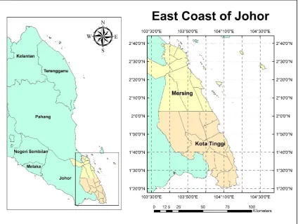
Figure 1.1 Location of the study area
1.5.2 Data
This study used both secondary and primary data. Primary data such as basic information of fishermen that include social and economic background, involvement in fishing activities and their knowledge in fishing were obtained through formal questionnaire surveys. Some of the related information were also obtained from secondary sources. Details on the collection of primary and secondary data will be explained in Chapter 3.
7
i. Local knowledge
Local knowledge is collected based on the interview and questionnaires distributed among the local community that had been carried out August 2014 along Mersing and Kota Tinggi coastal area.
ii. Remote sensing
Location of each identified fishing ground are analyzed using remote sensing technique based on two types of satellite images for each month in 2005 and 2014:
- MODIS SST: MOD28 - MODIS Chl-a: MOD21
1.6 Significance of Study
Based on present scenario of the fishing industry as a major contributor to the nation’s economy and the sustainability of food supply, it is very important to give
more attentions for the development of this sector. However the most important aspect related to the development of fishing activities is to identify strategies or ways of how to improve production and income of local fishermen. Among problems related to local fishermen are, (i) low catch, (ii) lack of knowledge in recent technologies, (iii) lack of knowledge in identifying potential fishing ground. Most of the local fishermen identify fishing ground based on traditional or local knowledge inherited from their ancestors.
Combination of these scientific and fishers’ observation will boost our
confidence in both approaches (Johannes et al., 2000), bridge some gaps in our knowledge (Mackinson, 2001) and produce scientifically valid and locally relevant information (Hall & Close, 2007). The integration between the practically local knowledge and scientifically remote sensing techniques can help fishermen in planning their fishing activities in a more proper and effective way. This will reduce their effort, cost and time spent on these activities.
73
REFERENCES
Abernethy, K. E., Allison, E. H., Molloy, P. P., Côté, I. M. (2007). Why do fishers fish where they fish? Using the ideal free distribution to understand the behaviour of artisanal reef fishers, Canadian Journal of Fisheries and Aquatic Sciences, 64, 1595-1604.
Ames, T. (2003). Putting fishermen's knowledge to work: the promise and pitfalls, Proceedings of Putting Fishers' Knowledge to Work, 27–30 August 2001,
Vancouver, Canada.
Andréfouët, S., Kramer, P., Torres-Pulliza, D., Joyce, K. E., Hochberg, E. J., Garza-Perez, R., Mumby, P. J., Riegl, B., Yamano, H., White, W. H., Zubia, M., Brock, J. C., Phinn, S. R., Naseer, A., Hatcher, B. G., Muller-Karger, F. E. (2003). Multi-site evaluation of IKONOS data for classification of tropical coral reef environments, Remote Sensing of Environment, 88, 128-143.
Anuchiracheeva, S., Demaine, H., Shivakoti, G. P., Ruddle K. (2003). Systematizing local knowledge using GIS: Fisheries management in Bang Saphan Bay, Thailand, Ocean & Coastal Management, 46, 1049-1068.
Aswani, S., Albert, S., Sabetian, A., Furusawa, T. (2007). Customary management as precautionary and adaptive principles for protecting coral reefs in Oceania, Coral Reefs, 26, 1009-1021.
Aswani, S., Lauer, M. (2006). Benthic mapping using local aerial photo-interpretation and resident taxa inventories for designing marine protected areas, Environmental Conservation, 33, 263-273.
Begossi, A. (2008). Local knowledge and training towards management, Environment, Development & Sustainability, 10, 591-603.
Berkes, F. (1993). Traditional ecological knowledge in perspective, In J.T. Inglis, (ed.), Traditional Ecological Knowledge Concepts and Cases. International Program
on Traditional Ecological Knowledge; International Development Research Centre, Ottawa, ON, Canada.
Berkes, F., Colding, J., Folke, C. (2010). Rediscovery of traditional ecological knowledge as adaptive management, Ecological Applications, 5, 1251-1262.
Bezerra, D. M. M., Nascimento, D. M., Ferreira, E. N., Rocha, P. D., Mourão, J. S. (2012). Influence of tides and winds on fishing techniques and strategies in the mamanguape River Estuary, Paraíba State, NE Brazil, Anais da Academia Brasileira de Ciencias, 84, 775-787.
Blondeau-Patissier, D., Gower, J. F. R., Dekker, A. G., Phinn, S. R., Brando, V. E. (2014). A review of ocean color remote sensing methods and statistical techniques for the detection, mapping and analysis of phytoplankton blooms in coastal and open oceans, Progress in Oceanography, 123, 123-144.
Bohensky, E. L., Maru, Y. (2011). Indigenous knowledge, science, and resilience: What have we learned from a decade of international literature on "integration"?, Ecology and Society, 16, 4.
Boomhover, J., Romero, M., Posada, J., Kobara, S., Heyman, W. D. (2010). Prediction and verification of possible reef-fish spawning aggregation sites in Los Roques Archipelago National Park, Venezuela, Journal of Fish Biology. Available from:
http://doi:10.1111/j.1095-8649.2010.02704.x [2nd July 2013].
Burke, J., Estrin, D.,Hansen, M., Parker, A., Ramanathan, N., Reddy, S., Srivastava, M. B. (2006). Participatory sensing, Center for Embedded Network Sensing. UCLA: Center for Embedded Network Sensing. Available from:
http://escholarship.org/uc/item/19h777qd
Butler, J. R. A., Tawake, A., Skewes, T., Tawake, L., Mcgrath, V. (2012). Integrating traditional ecological knowledge and fisheries management in the Torres Strait, Australia: the catalytic role of turtles and dugong, Ecology and Society, 17, 1-19. Butler, J. R. A., Wise, R. M., Skewes, T. D., Bohensky, E. L., Peterson, N., Suadnya, W., Yanuartati, Y., Handayani, T., Habibi, P., Puspadi, K., Bou, N., Vaghelo D., Rochester, W. (2015). Integrating Top-Down and Bottom-Up Adaptation Planning to Build Adaptive Capacity: A Structured Learning Approach, Coastal
Management, 43 (4), 346-364. Available from:
75
Chavula, G., Sungani, H., Gondwe, K. (2012). Mapping potential fishing grounds in Lake Malawi using AVHRR and MODIS satellite imagery, International Journal of
Geosciences, 3, 650-658. Available from
http://dx.doi.org/10.4236/ijg.2012.33065
Cinner, J. E., Aswani, S. (2007). Integrating customary management into marine conservation, Biological Conservation, 140, 201-216.
Cinti, A., Shaw, W., Torre, J. (2010), Insights from the users to improve fisheries performance: Fishers' knowledge and attitudes on fisheries policies in Bahia de Kino, Gulf of California, Mexico, Marine Policy, 34, 1322-1334.
Close, C. H., Hall, G. B. (2006). A GIS-based protocol for the collection and use of local knowledge in fisheries management planning, Journal of Environmental Management, 78, 341-352.
Cochrane, K. L. (2000). “Reconciling sustainability, economic efficiency and equity in fisheries: the one that got away?” Fish and Fisheries 1: 3-21.
Daqamseh, S. T., Mansor, S., Pradhan, B., Billa, L., Mahmud, A. R. (2013). Potential fish habitat mapping using MODIS-derived sea surface salinity, temperature and chlorophyll-a data: South China Sea Coastal areas, Malaysia, Geocarto International, 28 (6), 546-560. Available from:
http://dx.doi.org/10.1080/10106049.2012.730065
De Freitas, D. M., Tagliani P. R. A. (2009). The use of GIS for the integration of traditional and scientific knowledge in supporting artisanal fisheries management in southern Brazil, Journal of Environmental Management, 90, 2071-2080. Department of Fisheries, (2015). The Annual Fisheries Statistics Book 2014, Government
of Malaysia. Available from:
https://www.dof.gov.my/epms/index.php/pages/view/2600
Domeier, M. L., Colin, P. L. (1997). Tropical reef fish spawning aggregations defined and reviewed, Bulletin of Marine Science, 60, 698-726.
Drew, J. (2005). Use of traditional ecological knowledge in marine conservation, Conservation Biology, 19, 1286-1293.
Druon, J. N. (2010). Habitat mapping of the Atlantic bluefin tuna derived from satellite data: its potential as a tool for the sustainable management of pelagic fisheries. Marine Policy, 34, 293–297.
Food and Agriculture Organization of United Nation, Fisheries and Aquaculture Department (2009). The state of world fisheries and aquaculture 2008, Rome, Italy.
Food and Agriculture Organization of United Nation, Fisheries and Aquaculture Department (2013). The state of world fisheries and aquaculture 2012, Rome, Italy.
Franklin, E. C., Ault, J. S., Smith, S. G., Luo, J., Meester, G. A., Diaz, G. A., Chiappone, M., Swanson, D. W., Miller, S. L., Bohnsack, J. A. (2003). Benthic habitat mapping in the Tortugas region, Florida, Marine Geodesy, 26, 19-34.
Gomes, C., Mahon, R., Hunte, W., Singh-Renton, S. (1998). The role of drifting objects in pelagic fisheries in the southeastern Caribbean, Fisheries Research, 34, 47-58. Grant, S., Berkes, F. (2004). "One hand can't clap": Combining scientific and local knowledge for improved Caribbean fisheries management, Proceedings of 10th Biennial Conference of the International Association for the Study of Common
Property, Oaxaca, Mexico.
Grant, S., Berkes, F. (2007). Fisher knowledge as expert system: A case from the longline fishery of Grenada, the Eastern Caribbean, Fisheries Research, 84, 162-170. Hall, G. B., Close, C. H. (2007). Local knowledge assessment for a small-scale fishery
using geographic information systems, Fisheries Research, 83, 11-22.
Hall, G. B., Moore, A., Knight, P., Hankey, N. (2009). The extraction and utilization of local and scientific geospatial knowledge within the Bluff oyster fishery, New Zealand, Journal of Environmental Management, 90, 2055-2070.
Hamel, M. A., Andréfouët, S. (2010). Using very high resolution remote sensing for the management of coral reef fisheries: Review and perspectives, Marine Pollution Bulletin, 60, 1397-1405.
Heyman, W. D., Adrien, G. (2006). A protocol and database for monitoring transient multi-species reef fish spawning aggregations in the Meso-American reef, Proceedings of the Gulf and Caribbean Fisheries Institute, 57, 445-462.
Heyman, W. D., Ecochard, J. L. B., Biasi, F. (2007). Low-cost bathymetric mapping for tropical marine conservation – a focus on reef fish spawning aggregation sites, Marine Geodesy, 30, 37-50.
77
Heyman, W. D., Kjerfve, B. (2008). Characterization of transient multispecies reef fish spawning aggregations at Gladden Spit, Belize, Bulletin of Marine Science, 83, 531–551.
Heyman, W. D., Requena, N. (2002). Status of Multispecies Spawning Aggregations in Belize, Punta Gorda: The Nature Conservancy.
Hossain, M. S., Chowdhury, S. R., Chowdhury, M. A. T. (2007). Integration of remote sensing, GIS and participatory approach for coastal island resource use zoning in Bangladesh, Songklanakarin Journal of Social Science and Humanities, 13, 413-433.
Houts, M. E., Rodgers, R. D., Applegate R. D., Busby, W. H. (2008). Using local knowledge and remote sensing to map known and potential prairie-chicken distribution in Kansas, The Prairie Naturalist, 40, 3-4.
Hussain, M. Y., Abdul Manaf, A., Ramli, Z., Saad, S. (2011). Kesejahteraan sosial masyarakat nelayan: Kajian kes di Kampung Sri Bahagia, Mersing, Johor, Malaysian Journal of Society and Space, 7, 80-90.
Jiang, H. (2010). Stories remote sensing images can tell: integrating remote sensing analysis with ethnographic research in the study of cultural landscapes, Human Ecology, 31, 215-232.
Johannes, R. E. (1981). Words of the Lagoon: Fishing and Marine Lore in the Palau District of Micronesia, University of California Press, Berkeley.
Johannes, R. E. ed. (1989). Traditional ecological knowledge: a collection of essays, International Conservation Union (IUCN), Gland, Switzerland.
Johannes, R. E. (1998). The case for data-less marine resource management: examples from tropical nearshore fisheries, Trends in Ecology & Evolution, 13, 243-246. Johannes, R. E., Freeman, M. M. R., Hamilton, R. J. (2000). Ignore fishers’ knowledge
and miss the boat, Fish Fish, 1, 257-271.
Johnson, M. ed. (1992) Lore: Capturing Traditional Environmental Knowledge, Dene Cultural Institute, Ottawa.
Khalil, I. (2007) Seasonal and spatial variability of sea surface temperature (SST) and chlorophyll-a concentration using MODIS data in East Kalimantan waters, Indonesia.
Klemas, V. (2012). Remote sensing of environmental indicators of potential fish aggregation: An overview, Baltica, 25, 99-112.
Kobara, S. (2009) Regional analysis of seafloor characteristics at reef fish spawning aggregation sites in the Caribbean, PhD Thesis, Texas A&M University, College Station, TX, USA.
Kobara, S., Heyman, W. D. (2007). Caribbean-wide geospatial analysis of the location of transient reef fish spawning aggregation sites using remote sensing, Proceedings of the Gulf and Caribbean Fisheries Institute, 59, 463-465.
Kratzer, S., Harvey, E. T., Philipson, P. (2014). The use of ocean color remote sensing in integrated coastal zone management - A case study from Himmerfjärden, Sweden, Marine Policy, 43, 29-39.
Kumari, B., Raman, M., Mali, K. (2009). Locating tuna forage ground through satellite remote sensing. International Journal of Remote Sensing, 30, 5977–5988.
Lauer, M., Aswani, S. (2008). Integrating indigenous ecological knowledge and multi-spectral image classification for marine habitat mapping in Oceania, Ocean & Coastal Management, 51, 495-504.
Lillesand, T. M., Kiefer, R. W., Chipman, J. W. (2004). Remote Sensing and Image. Interpretation (5th ed.), John Wiley, New York.
Liu, J. G., Mason, P. J. (2009). Essential Image Processing for GIS and Remote Sensing. Wiley-Blackwell. p. 4. ISBN 978-0-470-51032-2.
Mackinson, S. (2001). Integrating local and scientific knowledge: an example in fisheries science, Environmental Management, 27, 533–545.
Mansor, S., Tan, C. K., Ibrahim, H. M., Mohd Shariff, A. R. (2001). Satellite Fish Forecasting in South China Sea, Proceedings of 22nd Asian Conference on Remote Sensing, 5-9 November 2001, Asian Association on Remote Sensing (AARS),
Singapore.
Mercer, J., Kelman, I., Taranis, L., Suchet Pearson, S. (2010). Framework for integrating indigenous and scientific knowledge for disaster risk reduction, Disasters, 34, 214-239.
79
Mishra, A. K., Kumar, S. (2013). Utility of Primary Productivity Map for Fishery Forecasting, Journal of the Indian Society of Remote Sensing, 41, 433-446. MRAG, (2010). Towards sustainable fisheries management: International Examples of
innovation, London, UK.
National Aeronautics and Space Administration (NASA), (2014). MODIS specifications. Available from: https://modis.gsfc.nasa.gov/about/specifications.php
Ocean Biology Processing Group (OBPG) at NASA's Goddard Space Flight Center, (2014). MODIS product algorithm description. Available from:
https://oceancolor.gsfc.nasa.gov/cms/atbd
Persatuan Nelayan Kawasan (PNK), (2014). Background information of fishermen in Endau, Mersing, Sedili and Pengerang.
Puri, S. (2007). Integrating scientific with indigenous knowledge: constructing knowledge alliances for land management in India, MIS Quarterly, 31, 355-379. Raymond, C. M., Fazey, I., Reed, M. S., Stringer, L. C., Robinson, G. M., Evely, A. C.
(2010). Integrating local and scientific knowledge for environmental management, Journal of Environmental Management, 91, 1766-1777.
Reiss, C. S., Checkley, D. M., Bograd, S. J. (2008). Remotely sensed spawning habitat of Pacific sardine (Sardinops sagax) and northern anchovy (Engraulis mordax) within the California Current. Fisheries Oceanography, 17, 126–136.
Riolo, F. (2006). A geographic information system for fisheries management in American Samoa, Environmental Modelling and Software, 21, 1025-1041.
Sa’at, N. H. (2011). Social mobility among the coastal community: a case study in Kuala
Terengganu, Kajian Malaysia, 29 (1), 95-123.
Saitoh, S. I., Mugo, R., Radiarta, I. N., Asaga, S., Takahashi, F., Hirawake, T., Ishikawa, Y., Awaji, T., In, T., Shima, S. (2011). Some operational uses of satellite remote sensing and marine GIS for sustainable fisheries and aquaculture, 68, 687-695. Salk, C., Sturn, T., See, L., Fritz, S. (2016). Local knowledge and professional
background have a minimal impact on volunteer citizen science performance in a land-cover classification task, Remote Sensing, 8, 774-787.
Santos, A. M. P. (2000). Fisheries oceanography using satellite and airborne remote sensing methods: a review, Fisheries Research, 49, 1-20.
Schott, J. R. (2007). Remote sensing: the image chain approach (2nd ed.), Oxford University Press, p. 1. ISBN 978-0-19-517817-3.
Schowengerdt, R. A. (2007). Remote sensing: models and methods for image processing (3rd ed.). Academic Press. p. 2. ISBN 978-0-12-369407-2.
Selgrath, J. C., Roelfsema, C., Gergel, S. E., Vincent, A. C. J. (2016). Mapping for coral reef conservation: comparing the value of participatory and remote sensing approaches, Ecosphere. Available from: http://doi:10.1002/ecs2.1325
Sillitoe, P. (1998). The development of indigenous knowledge: a new applied anthropology, Current Anthropology, 39, 223-52.
Silvano, R. A. M., Begossi, A. (2005). Local knowledge on a cosmopolitan fish ethnoecology of Pomatomus saltatrix (Pomatomidae) in Brazil and Australia, Fisheries Research, 71, 43-59.
Silvano, R. A. M., Valbo-Jørgensen, J. (2008). Beyond fishermen's tales: Contributions of fishers' local ecological knowledge to fish ecology and fisheries management, Environment, Development and Sustainability, 10, 657-675.
Solanki, H. U., Dwivedi, R. M., Nayak, S. R., Somvanshi, V. S., Gulati, D. K., Pattnayak, S. K. (2003).Fishery forecast using OCM chlorophyll concentration and AVHRR SST: validation results off Gujarat coast, India. International Journal of Remote Sensing, 24, 3691–3699.
Stuart, V., Platt, T., Sathyendranath, S. (2011). The future of fisheries science in management: a remote-sensing perspective, ICES Journal of Marine Science, 68, 644-650.
Tamelander, J., Sattar, S., Satapoomin, U., Campbell, S., Patterson Edward, J. K., Hoon, V., Chandi, M., Arthur, R., Adam, S., Samoilys, M. (2008). Reef fish spawning aggregations in South Asia and Andaman Sea: Preliminary findings from local knowledge, CORDIO Status Report 2008, Coastal Oceans Research and Development in the Indian Ocean/Sida-SAREC, Mombasa, pp 277-281.
Tripathi, N., Bhattarya, S. (2004). Integrating indigenous knowledge and GIS for participatory natural resource management: state-of-the-practise, The Electronic Journal of Information Systems in Developing Countries, 17, 1-13.
Vajjhala, S. P. (2005). Integrating GIS and participatory mapping in community development planning, Paper for the ESRI International User Conference, Sustainable Development and Humanitarian Affairs Track, July 2005, San Diego,
81
Valavanis, V. D., Georgakarakos, S., Kapantagakis, A., Palialexis, A., Katara, I. (2004). A GIS environmental modelling approach to essential fish habitat designation, Ecological Modelling, 178, 417-427.
Valavanis, V. D., Pierce, G. J., Zuur, A. F., Palialexis, A., Saveliev, A., Katara, I., Wang, J. (2008). Modelling of essential fish habitat based on remote sensing, spatial analysis and GIS, Hydrobiologia, 612, 5-20.
Warren, D. M. (1995). Comments on article by Arun Agrawal. Indigenous Knowledge and Development Monitor 4, 13.
Yen, K. W., Lu, H. J., Chang, Y., Lee, M. A. (2012). Using remote-sensing data to detect habitat suitability for yellowfin tuna in the Western and Central Pacific Ocean, International Journal of Remote Sensing, 33 (23), 7507-7522.
Zagaglia, C. R., Lorenzzetti, J., Stech, J. L. (2004). Remote sensing data and longline catches of yellowfin tuna (Thunnus albacores) in the equatorial Atlantic, Remote Sensing of Environment, 93, 267-281.
Zainuddin, M., Kiyofuji, H., Saitoh, K., Saitoh, S. (2006). Using multi-sensor satellite remote sensing and catch data to detect ocean hot spots for albacore (thunnus alalunga) in the northwestern North Pacific, Deep-Sea Research II, 53, 419-431. Zukowski, S., Curtis, A., Watts, R. J. (2010). Using fisher local ecological knowledge to