Imperial County Planning & Development Services Department 3.1-1 ESA / 211326 Cluster I Solar Power Project Draft Environmental Impact Report December 2011
CHAPTER 3
Environmental Setting, Impacts, and
Mitigation Measures
3.1 Aesthetics
This section discusses impacts associated with the potential for the proposed project to degrade the existing visual character or quality of the site and its surroundings through changes in the existing landscape. Potential effects are evaluated relative to important visual features (e.g., scenic highways, scenic features) and the existing visual landscape and its users.
Degradation of the visual character of a site is usually addressed through a qualitative evaluation of the changes to the aesthetic characteristics of the existing environment, and the proposed project-related modification that would alter the visual setting.
3.1.1 Environmental Setting
Concepts and Terminology
The following terms and concepts are used in the discussion below to describe and assess the aesthetics setting and impacts from the proposed project. Potentially sensitive viewpoints (those viewpoints from which project impacts are assessed) typically include any scenic vistas, scenic highways, residential views, public parks, recreational areas, and/or culturally important locations from which the project could potentially be visible.
Key Observation Point. One or a series of points on a travel route or at a use area or potential use area where the view of a management activity (project) would be the most revealing.
Scenic vista. An area that is designated, signed, and accessible to the public for the express purposes of viewing and sightseeing. This includes any such areas designated by a federal, state, or local agency.
Scenic highway. Any stretch of public roadway that is designated as a scenic corridor by a federal, state, or local agency. Residential viewers typically have extended viewing periods and are generally considered to have high visual sensitivity. For this reason, residential views are typically considered sensitive. Views from public parks, recreational trails, and/or culturally important sites also have high visual sensitivities and are therefore considered as sensitive viewpoints.
3. Environmental Setting, Impacts, and Mitigation Measures 3.1 Aesthetics
Imperial County Planning & Development Services Department 3.1-2 ESA / 211326 Cluster I Solar Power Project Draft Environmental Impact Report December 2011
Sensitive receptors or sensitive viewpoints. Any scenic vista, scenic highway, residence, or public recreational area located within the project viewshed that provide people with views of a site.
Viewshed. The landscape that can be directly seen under favorable atmospheric conditions, from a viewpoint or along a transportation corridor.
Regional Setting
The three sites that comprise the proposed project are located in Imperial County, which extends over 4,597 square miles between Riverside County, the Mexican border, San Diego County, and the State of Arizona. The region contains a wealth of scenic visual resources, including desert areas, sand hills, mountains, and the Salton Sea. Land uses in the region consist primarily of vacant land and agricultural land. Urban areas near the proposed project include the City of Calipatria, El Centro, and Brawley.
The desert areas of Imperial County include the Yuha Desert, the West Mesa area, which is bordered on the east by the Algodones Sand Dunes, lower Borrego Valley, East Mesa, and Pilot Knob Mesa. Mountains make up another significant visual resource of Imperial County. On the west side of the county are the eastern foothills of the Peninsular Range. The Chocolate
Mountains are located in the northeastern portion of the county, stretching northwest by southeast between Riverside County and the Colorado River. These mountains reach an elevation of 2,700 feet and are highly visible throughout the county. They are extremely rugged, virtually
undeveloped, and used as a naval gunnery range (County of Imperial, 1993).
Prominent landmarks visible from much of Imperial County include the Superstition Mountains and Superstition Hills, which are located southeast of lower Borrego Valley, west of El Centro, and Mount Signal, which is located on the eastern edge of the Yuha Desert, west of Calexico. The Salon Sea, which covers 376 square miles is located approximately five miles northwest of the Midway I and Midway II sites, and approximately seven miles from Calipatria I. This Sea is the largest lake in California and the third largest saline lake in the nation. It serves as an agricultural drainage reservoir and consists primarily of commercial agricultural drainage. Surrounding the Sea, are wildlife refuge lands, seaside dwellings, marinas and boat facilities, as well as a State Recreation Area, which has 1,400 campsites, hundreds of picnic sites, trails, playgrounds, boat ramps and a visitors center. Facilities provide opportunities for bird watching, fishing, boating, camping, off-roading, hiking, hunting and photography (The Salton Sea
Authority, 2011).
The closest parks to the project’s sites include Red Hill Marina Regional Park, which is six miles northwest of the project, and Wiest Lake Regional Park, which is 6.5 miles south of the project’s sites. The closest wilderness and recreational areas include the North Algodones Dunes
Wilderness and Watchable Wildlife Site, which is 22 miles southeast of the project, and the Superstition Mountain OHV Area, which is 22 miles southwest of the project’s sites. The State
3. Environmental Setting, Impacts, and Mitigation Measures 3.1 Aesthetics
Imperial County Planning & Development Services Department 3.1-3 ESA / 211326 Cluster I Solar Power Project Draft Environmental Impact Report December 2011 Department of Corrections owns a maximum-security prison in an area northeast of the City of Calipatria, and a medium-security prison near Seeley.
Scenic Highways
Four areas of Imperial County have the potential as state-designed scenic highways. The following routes are eligible for state scenic highway designation:
Interstate 8 (I-8). The initial segment for future Scenic Highway Designation status lies between the San Diego County line and its junction with SR-98. This segment known as Mountain Springs Grade has a long, rapid elevation change, remarkable rock and boulder scenery, and plant life variations. This segment is approximately 45 miles southwest of the proposed project area.
SR-78. The portion of SR-78 from the junction with SR-86 to the San Diego County line is eligible for future Scenic Highway Designation. That area is considered scenic because of its desert characteristics and view of Salton Sea. This segment is approximately 20 miles west of the proposed project area.
SR-111. SR-111 travels along the northeast shore of the Salton Sea and is eligible for future Scenic Highway Designation from Bombay Beach to the County line. The drive contrasts the flat, wide portions of the Salton Sea, with the rugged variations of the
Chocolate Mountains. This segment is approximately 18miles north of the proposed project area.
Borrego-Salton Seaway. County Highway S-22 is also known as Borrego-Salton Seaway, it begins in Salton City and ends at the community of Borrego Springs in San Diego County. This route includes views of Clay point, the Anza Verde Wash and scenic
viewpoints. This segment is approximately 30 miles northwest of the proposed project area (County of Imperial, 2008).
Project Areas
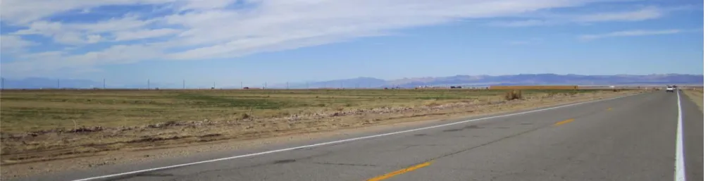
The proposed project would be developed on three site locations Calipatria I, Midway I and Midway II, in an agricultural area of Imperial County, 2.5 miles north of the City of Calipatria, as illustrated in Figure 3.1-1. The three sites are located on both sides–east and west–of SR-111. The proposed project areas consist of undeveloped lands and areas used for farming and grazing; therefore, there are no agricultural buildings or residential structures on the project sites. The project sites are relatively level at elevations that range from 175 to 207 feet below msl across the three locations. The regional ground surface slopes toward the west up to about a 0.5 percent gradient. There are no bodies of surface water on the project sites or on the adjacent parcels of land The proposed project sites are not located within a designated or eligible state scenic highway or route according to Caltrans California Scenic Highway Mapping System (Caltrans 2009) or the Imperial County Circulation and Scenic Highways Element (Imperial County 2008).
CUP #10-0036 Midway Solar Farm I (83WI)
CUP #10-0037
Midway Solar Farm II (97WI)
CUP #10-0034
Calipatria Solar Farm I (70SM)
111 30 115 26 78 Niland Iris Calipatria Wiest Westmorland S a l t o n S e a A la m o R i v er Niland Iris Calipatria Wiest Westmorland S a l t o n S e a A la m o R i v er Area of Detail 0 2 Miles Figure 3.1-1 Site Location Map SOURCE: NAIP Imagery, 2009; and ESA, 2011 8 Minute Energy Cluster I Solar Farm . 211326
3. Environmental Setting, Impacts, and Mitigation Measures 3.1 Aesthetics
Imperial County Planning & Development Services Department 3.1-5 ESA / 211326 Cluster I Solar Power Project Draft Environmental Impact Report December 2011
Calipatria I
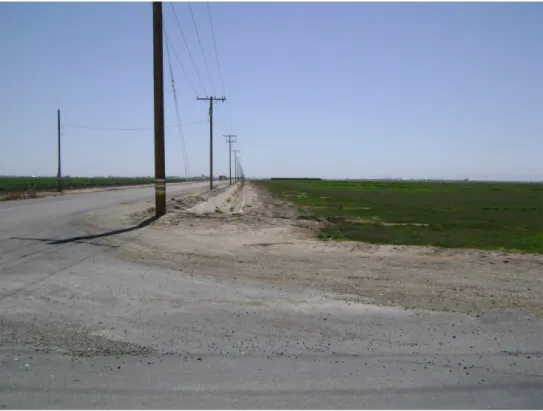
Calipatria I is located directly north of the City of Calipatria in an unincorporated area of the County of Imperial. The site is bounded by Blair Road to the east, Young Road to the south, Lindsey Road to the north, and the farmland to the west, comprising approximately 609 acres of land. The site is in current crop production, and an overhead power transmission line runs north-south through the middle of the site and along Young Road. The Union Pacific Railroad (UPRR) tracks run north-south through the site near the western boundary of the site, and fertilizer tank trailers are stored in the southwest corner of the site, north of Young Road (GS Lyon, 2010c). Calipatria I is located about one half mile northeast of the Cliff Hatfield Memorial Airport (general aviation traffic only and light commercial jets/prop jets). Calipatria I is surrounded by agricultural fields in current crop production with the exception of the southwest corner, which borders the City of Calipatria, as shown in Figures 3.1-2 through 3.1-7. Therefore, the southwest corner of the site borders a mixture of industrial, commercial and residential buildings and infrastructure.
8 Minute Energy Cluster I Solar Farm . 211326 Figures 3.1-2 and 3.1-3
Site Photos
SOURCE: 8minutenergy Renewables, 2011.
Figure 3.1-2. Looking east across the southern boundary of the site along Hwy 115.
8 Minute Energy Cluster I Solar Farm . 211326 Figures 3.1-4 and 3.1-5
Site Photos
SOURCE: 8minutenergy Renewables, 2011.
Figure 3.1-4. Looking north at the boundary between a vacant area and the site, east of the railroad tracks north of Young Road.
8 Minute Energy Cluster I Solar Farm . 211326 Figures 3.1-6 and 3.1-7
Site Photos
SOURCE: 8minutenergy Renewables, 2011.
Figure 3.1-6. Power lines traveling south across thecenter of the site.
Figure 3.1-7. Debris between the eastside of the railroad tracks and the site boundary, north of Wilkinson Road.
3. Environmental Setting, Impacts, and Mitigation Measures 3.1 Aesthetics
Imperial County Planning & Development Services Department 3.1-9 ESA / 211326 Cluster I Solar Power Project Draft Environmental Impact Report December 2011
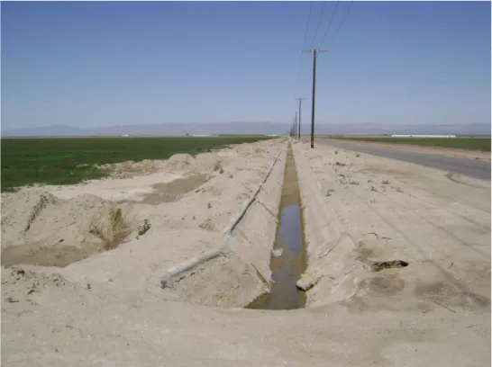
Midway I
Midway I is located approximately 2.5 miles northwest of the City of Calipatria and is bounded English Road to the east, Sinclair Road to the north, East Peterson Road to the south, and private roads to the west, comprising of approximately 326 acres. The site is comprised of two
agricultural fields that are currently in production. An overhead transmission line runs along the northern boundary of the site (GS Lyon, 2010a). The property is bisected by East Hoober Road, with a concrete lined canal (“J” Lateral) and a drainage ditch.
Midway I is surrounded agricultural fields that are currently in crop production, as shown in
Figures 3.1-8 through 3.1-11. The site is located approximately one half mile southeast of a geothermal power plant with steam turbines and cooling towers. Additionally, Brandt Cattle (large feedlot) is located approximately one half mile southwest of the subject site, west of Brandt Road. The Alamo River is located just over one half mile west of the subject site. The site is about 2.5 miles northwest of the Cliff Hatfield Memorial Airport.
8 Minute Energy Cluster I Solar Farm . 211326 Figures 3.1-8 and 3.1-9
Site Photos
SOURCE: 8minutenergy Renewables, 2011.
Figure 3.1-8. From the northeast corner, looking south.
8 Minute Energy Cluster I Solar Farm . 211326 Figures 3.1-10 and 3.1-11
Site Photos
SOURCE: 8minutenergy Renewables, 2011.
Figure 3.1-10. From the southeast corner, looking north.
3. Environmental Setting, Impacts, and Mitigation Measures 3.1 Aesthetics
Imperial County Planning & Development Services Department 3.1-12 ESA / 211326 Cluster I Solar Power Project Draft Environmental Impact Report December 2011
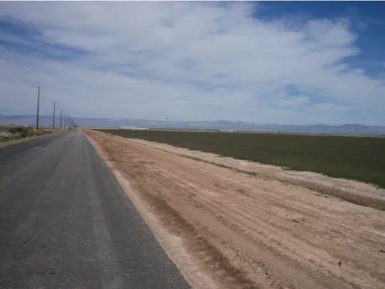
Midway II
Midway II is located approximately 1 mile northwest of the City of Calipatria and is bounded by English Road to the west, East Hoober Road to the north, Montgomery Road and Lindsey Road to the south, and a private road to the east, comprising of approximately 803 acres. The site consists of six agricultural fields that are currently in production. The property is bisected by two dirt roads (Montgomery and East Peterson), with concrete lined canals (“H” and “I” Laterals) and drainage ditches. A separate concrete lined canal (“G” Lateral) abuts the southern boundary of the site. An overhead transmission line runs adjacent to the western boundary of the site, along the west side of English Road (GS Lyon, 2010b).
Properties surrounding Midway II are agricultural lands, as shown in Figures 3.1-12 through
3.1-15. A farming house and yard are located adjacent to the southwest corner of the subject site. A commercial algae farm (shallow ponds) is located approximately 1 mile east of the subject site. Brandt Cattle (large feedlot) is located approximately 1 mile west of the subject site.
8 Minute Energy Cluster I Solar Farm . 211326 Figures 3.1-12 and 3.1-13
Site Photos
SOURCE: 8minutenergy Renewables, 2011.
Figure 3.1-12. From the southwest corner, looking north.
8 Minute Energy Cluster I Solar Farm . 211326 Figures 3.1-14 and 3.1-15
Site Photos
SOURCE: 8minutenergy Renewables, 2011.
Figure 3.1-14. Farm buildings located adjacent to the southwest corner of the site.
3. Environmental Setting, Impacts, and Mitigation Measures 3.1 Aesthetics
Imperial County Planning & Development Services Department 3.1-15 ESA / 211326 Cluster I Solar Power Project Draft Environmental Impact Report December 2011
3.1.2
Regulatory Framework
State
California Scenic Highway Program
The State Legislature created the California Scenic Highway Program in 1963. Its purpose is to preserve and protect scenic highway corridors from change that would diminish the aesthetic value of lands adjacent to highways. The State Scenic Highway System includes a list of highways that are either eligible for designation as scenic highways or have been so designated. Cities and counties can nominate eligible scenic highways for official designation by identifying and defining the scenic corridor of the highway. The municipality must also adopt ordinances to preserve the scenic quality of the corridor or document such regulations that already exist in various portions of local codes.
A segment of Interstate 8 proposed for Scenic Highway Designation status lies between the San Diego county line and the interstate’s junction with SR-98 (Caltrans 2009). This segment, known as Mountain Springs Grade, has a long, rapid elevation change, remarkable rock and boulder scenery, and plant life variations (County of Imperial 2008). The proposed project is not located within this area. A segment of SR-78 proposed for future Scenic Highway Designation status is the closest to the proposed project site. It is located west of the Salton Sea and is not located near the project site. Thus, the project site is not in the viewshed from this stretch of SR-78.
Local
County of Imperial General Plan
The Imperial County General Plan serves as the overall guiding policy for the County. Although the Open Space and Conservation Element and the Land Use Element of the General Plan include goals and objectives for preservation of visual resources, no policies within these elements have been established that are relevant to the proposed project. Relevant goals and policies from the Circulation and Scenic Highways Element are listed below.
Circulation and Scenic Highways Element
Goal 4: The County shall make every effort to develop a circulation system that highlights and preserves the environmental and scenic amenities of the area. Objective 4.3: Protect areas of outstanding scenic beauty along any scenic highways and protect
the aesthetics of those areas.
Scenic Highway Program/Landscaping
Objective: The purpose of this program is to protect and enhance the County’s scenic, historic, and recreational resources within a network of scenic highway corridors. This shall also include landscape standards from streets and roads particularly in urban areas.
3. Environmental Setting, Impacts, and Mitigation Measures 3.1 Aesthetics
Imperial County Planning & Development Services Department 3.1-16 ESA / 211326 Cluster I Solar Power Project Draft Environmental Impact Report December 2011 Policies: The County shall emphasize protection of scenic highway resources in all County
actions affecting land use.
3.1.3 Impacts and Mitigation Measures
This section describes the impact analysis relating to aesthetics for the proposed project. It describes the methods used to determine the impacts of the project and lists the thresholds used to conclude whether an impact would be significant. Measures to mitigate (i.e., avoid, minimize, rectify, reduce, eliminate, or compensate for) significant impacts accompany each impact discussion, where applicable.
Methodology
In general, the potential aesthetic, light, and glare impacts associated with the proposed project are evaluated on a qualitative basis. The evaluation of impacts are based on professional judgment, analysis of the Imperial County General Plan goals and policies related to visual resources and the significance criteria established by CEQA.
This visual impact assessment is being utilized to identify and assess any potential long-term adverse visual impacts on aesthetics and visual resources that might result from implementation of the proposed project. This assessment is based on the approved visual assessment practices employed by the Federal Highway Administration (1981), the BLM (1978), the U.S. Forest Service (1995), and other federal regulatory agencies. This method includes:
Defining the project and its visual setting;
Identifying sensitive viewpoints for assessment;
Analyzing the baseline visual quality and character of the identified views;
Depicting the visual appearance of the project from identified views;
Assessing the project’s impacts to those views in comparison to their baseline visual quality and character; and
Proposing methods to mitigate any potentially significant visual impacts identified.
Simulation Preparation
Simulations of the proposed project were prepared to provide a comparison of the conditions prior to project construction activities and to allow for visual comparison as well as provide a qualitative description of the aesthetic changes that would result from the proposed project. The simulations were produced in January 2011, by Modative.
A comparison of existing views of the site with visual simulations depicting visible project features (Figures 4.1-8 through 4.1-13), aided in determining project-related impacts. The
simulations present a representative sample of the existing landscape settings contained within the project area, as well as an illustration of how the project may look from key observational points.
3. Environmental Setting, Impacts, and Mitigation Measures 3.1 Aesthetics
Imperial County Planning & Development Services Department 3.1-17 ESA / 211326 Cluster I Solar Power Project Draft Environmental Impact Report December 2011
Standards for Determining Visual Impact Significance
Appendix G of the CEQA Guidelines contains a brief checklist of environmental effects that may be considered significant. These are described under “Thresholds of Significance,” below. The CEQA checklist questions have been used as guidelines for assessing the potential
significance of the proposed project’s visual impacts and for determining which land uses are to be considered “potentially sensitive viewpoints” in this analysis.
Potentially sensitive viewpoints (those viewpoints from which project impacts are assessed) typically include any scenic vistas, scenic highways, major roads or highways, residential views, public parks, recreational areas, and/or culturally important locations from which the project could potentially be visible.
A “scenic vista,” as defined for this analysis, is an area that is designated, signed, and accessible to the public for the express purposes of viewing and sightseeing. This includes any such areas designated by a federal, state, or local agency. A “scenic highway,” as defined for this analysis, is any stretch of public roadway that is designated as a scenic corridor by a federal, state, or local agency. Residential viewers typically have extended viewing periods and are generally
considered to have high visual sensitivity. For this reason, residential views are typically
considered sensitive. Views from public parks, recreational trails, and/or culturally important sites also have high visual sensitivities and are therefore considered as sensitive viewpoints.
Rating Visual Quality
“Visual quality” is a measure of a landscape or view’s visual appeal. While there are a number of standardized methods for rating visual quality, the “Scenic Quality Rating Criteria” method utilized by the BLM is believed to be superior because it allows the various landscape elements that comprise visual quality to be easily quantified and rated with a minimum of ambiguity or subjectivity.
According to this method, visual quality is rated according to the presence and characteristics of seven key components of the landscape. These components include landform, vegetation, water, color, adjacent scenery, scarcity and cultural modifications.
1. The landform component of the visual quality rating criteria takes into account the fact that topography becomes more interesting visually as it gets steeper or more massive, or more severely or universally sculptured. Outstanding landforms may be monumental, (as found in Yosemite Valley), or they may be exceedingly artistic and subtle (such as certain badlands, pinnacles, arches, and other extraordinary formations).
2. The vegetation component of the rating criteria gives primary consideration to the variety of patterns, forms, and textures created by plant life. Short-lived displays are given consideration when they are known to be recurring or spectacular. Consideration is also given to smaller scale vegetational features that add striking and intriguing detail elements to the landscape (e.g., gnarled or windbeaten trees, Joshua trees, etc.).
3. Environmental Setting, Impacts, and Mitigation Measures 3.1 Aesthetics
Imperial County Planning & Development Services Department 3.1-18 ESA / 211326 Cluster I Solar Power Project Draft Environmental Impact Report December 2011
3. The water component of the rating criteria recognizes that visual quality is largely tied to the presence of water in scenery, as it is that ingredient which adds movement or serenity to a scene. The degree to which water dominates the scene is the primary consideration in selecting the rating score for the water component.
4. The color component of the visual quality rating criteria considers the overall color(s) of the basic components of the landscape (e.g., soil, rock, vegetation, etc.). Key factors that are used when rating the color of scenery are variety, contrast, and harmony.
5. The adjacent scenery component of the rating criteria takes into account the degree to which scenery outside the view being rated enhances the overall impression of the scenery under evaluation evaluated. The distance of influence for adjacent scenery normally ranges from 0-5 miles, depending upon the characteristics of the topography, the vegetation cover, and other such factors. This factor is generally applied to views that would normally rate very low in score, but the influence of the adjacent high visual quality would enhance the visual quality and raise the score.
6. The scarcity component of the visual quality rating criteria provides an opportunity to give added importance to one or all of the scenic features that appear to be relatively unique or rare within a region. There may also be cases where a separate evaluation of each of the key factors does not give a true picture of the overall scenic quality of an area. Often, it is a number of not so spectacular elements in the proper combination that produces the most pleasing and memorable scenery – the scarcity factor can be used to recognize this type of area and give it the added emphasis it should have.
7. The cultural modifications component of the visual quality rating criteria takes into account any manmade modifications to the landform, water, vegetation, and/or the addition of manmade structures. Depending on their character, these cultural
modifications may detract from the scenery in the form of a negative intrusion or they may complement and improve the scenic quality of a view.
Based on the above criteria, views are rated numerically and a total score of visual quality can be tabulated. Based on the BLM’s rating system, there are a total of 32 points possible. Views that score a total of 19 points or more are typically considered very high in visual quality. Views that score a total of 15 to 19 points are typically considered to have a high level of visual quality. Views that score a total of 12 to 15 points are typically considered to have an above average level of visual quality. And views that score a total of 11 points or less are typically considered to have average visual quality. See Table 3.1-1 for the point values associated with the various criteria. An important premise of this evaluation method is that views with the most variety and most harmonious composition have the greatest scenic value. Another important concept is that manmade features within a landscape do not necessarily detract from the scenic value. In fact, certain manmade features that complement the natural landscape may actually enhance the visual quality. In making this determination, it is therefore important to assess project effects relative to the “visual character” of the project setting. Visual character is qualitatively defined by four primary components: form, line, color, and texture.
3. Environmental Setting, Impacts, and Mitigation Measures 3.1 Aesthetics
Imperial County Planning & Development Services Department 3.1-19 ESA / 211326 Cluster I Solar Power Project Draft Environmental Impact Report December 2011
TABLE 3.1-1
VISUAL QUALITY RATING SYSTEM
Key Factors Rating Criteria and Score
Landform High vertical relief as
expressed in prominent cliffs, spires, or massive rock outcrops, or severe surface variation or highly eroded formations including major badlands or dune systems; or detail features dominant and exceptionally striking and intriguing such as glaciers.
Steep canyons, mesas, buttes, cinder cones, and drumlins; or interesting erosional patterns or variety in size and shape of landforms; or detail features which are interesting though not dominant or exceptional.
Low rolling hills, foothills, or flat valley bottoms; or few or no interesting landscape features.
Score: 5 Score: 3 Score: 1
Vegetation A variety of vegetative types
as expressed in interesting forms, textures, and patterns.
Some variety of vegetation, but only one or two major types.
Little or no variety or contrast in vegetation.
Score: 5 Score: 3 Score: 1
Water Clear and clean appearing,
still, or cascading white water, any of which are a dominant factor in the landscape.
Flowing, or still, but not dominant in the landscape.
Absent, or present but not noticeable.
Score: 5 Score: 3 Score: 1
Color Rich color combinations,
variety or vivid color; or pleasing contrasts in the soil, rock, vegetation, water or snow fields.
Some intensity or variety in colors and contrast of the soil, rock, and vegetation, but not a dominant scenic element.
Subtle color variations, contrast, or interest; generally mute tones.
Score: 5 Score: 3 Score: 1
Influence of Adjacent Scenery
Adjacent scenery greatly enhances visual quality.
Adjacent scenery moderately enhances overall visual quality.
Adjacent scenery has little or no influence on overall visual quality.
Score: 5 Score: 3 Score: 1
Scarcity One of a kind; or unusually
memorable, or very rare within region. Consistent chance for exceptional wildlife or wildflower viewing, etc.
Distinctive, though somewhat similar to others within the region.
Interesting within its setting but fairly common within the region.
Score: 5 Score: 3 Score: 1
Cultural Modifications
Modifications add favorably to visual variety while promoting visual harmony.
Modifications add little or no visual variety to the area, and introducing no discordant elements.
Modifications add variety but are very discordant and promote strong disharmony.
Score: 2 Score: 0 Score: -4
Generally speaking, projects that create a high level of contrast to the existing visual character of a project setting are more likely to generate adverse visual impacts due to visual incompatibility. Conversely, projects that create a low level of contrast to the existing visual character are less likely to generate adverse visual impacts due to inherent visual compatibility.
3. Environmental Setting, Impacts, and Mitigation Measures 3.1 Aesthetics
Imperial County Planning & Development Services Department 3.1-20 ESA / 211326 Cluster I Solar Power Project Draft Environmental Impact Report December 2011 By comparing the difference in visual quality ratings from the baseline (“before” condition) to post-project (“after” condition) visual conditions, the severity of project related visual impacts can be quantified. However, in some cases, visual changes caused by projects may actually have a beneficial visual effect and may enhance scenic quality.
The following designations are used to rank the significance of project impacts according to the pre- and post-project differences in numerical visual quality scores:
Potentially Significant Impact: Any impact that could potentially lower the visual quality of an identified sensitive viewpoint by 2 points, or more, and for which no feasible or effective mitigation can be identified.
Less Than Significant Impact with Mitigation Incorporated: Any impact that could potentially lower the visual quality of an identified sensitive viewpoint by 2 points or more, but can be reduced to less than 2 points with mitigation incorporated. Therefore, specific mitigation measures are provided to reduce the impact to a less-than-significant level.
Less Than Significant Impact: Any impact that could potentially lower the visual quality of an identified sensitive viewpoint by 1 point or less. In visual impact analysis, a less than significant impact usually occurs when a project’s visual modifications can be seen but do not dominate, contrast with, or strongly degrade a sensitive viewpoint.
No Impact: The project would not have an impact from an identified sensitive viewpoint. In visual impact analysis, there is no impact if the project’s potential visual modifications cannot be seen from an identified sensitive viewpoint.
Analyzing Sources of Light and Glare
Good Company conducted the reflectivity studies for Calipatria I (March 2011), Midway Solar I (December 2010), and Midway II (December 2010), to assess the project’s potential for glare along nearby traffic corridors. The study concluded that the panels’ orientation for either fixed-tilt or single-axis tracking solar panels results in angles of reflection well above the built environment and nearby traffic corridors.
Regarding night lighting conditions – as well as daytime glare conditions - “light” refers to artificial light emissions, or the degree of brightness, generated by a given source. The
Illuminating Engineering Society of North America (IES, 1993) defines “glare” as the sensation produced by luminance in the visual field that is sufficiently greater than the luminance to which the eye has adapted to cause annoyance, discomfort, or loss of visual performance and visibility. The existing conditions of light and glare are defined by the following characteristics:
1. Lighting Character: The character of lighting is defined in terms of the types of lighting present and their pattern of illumination. Illumination maybe described in terms of: (1) Ambient Lighting, the general overall level of lighting in a given area due to the various light sources present; (2) Corona, which is the diffuse halo of light that exists above a lit area, usually against a dark background and discerned only at substantial distances; and (3) Glare, as defined above: focused, intense, point-source or reflected light. Being a negative occurrence of direct or reflected light, glare is not described as
3. Environmental Setting, Impacts, and Mitigation Measures 3.1 Aesthetics
Imperial County Planning & Development Services Department 3.1-21 ESA / 211326 Cluster I Solar Power Project Draft Environmental Impact Report December 2011 part of the inherent character of lighting in an area. It would be an adverse effect of past actions.
2. Congruence (Intactness): As with daytime visual conditions, this attribute is the degree to which past actions have noticeably and unfavorably changed the type and/or intensity of lighting in an area such that the result appears incongruent with the inherent character of lighting there.
3. Coherence (Unity): This attribute, as it pertains to lighting, is the internal consistency of scale, pattern and organization of the sources and effect of lighting relative to the
potentially affected area.
Thresholds of Significance
The Imperial County CEQA Implementation Document and Imperial County Environmental Checklist identify the following criteria, as established in Appendix G of the CEQA Guidelines, to determine if a project could potentially have a significant adverse effect on aesthetics if it would:
Has a substantial adverse effect on a scenic vista;
Substantially degrade the existing visual character or quality of the site and its surroundings; or
Create a new source of substantial light or glare which would adversely affect daytime or nighttime views in the area.
The following criteria were eliminated from the EIR scope of analysis based on the findings made in the IS/NOP published for the proposed project. Please refer to Appendix A of this EIR for a copy of the IS/NOP and additional information regarding these issue areas. A project could have a have a significant adverse affect on aesthetics if it would:
Substantially damage scenic resources, including, but limited to, trees, rock outcroppings, and historic buildings within a state scenic highway.
Project Impacts
Impact 3.1-1: Would the project have a substantial adverse effect on a scenic vista or scenic highway?
Imperial County contains a wealth of scenic visual resources. These visual resources include desert areas, sand hills, mountains, and the Salton Sea. The proposed project is located south of the Salton Sea in the approximate center of the Imperial Valley agricultural area and is
surrounded by miles of topographically flat agricultural land. Therefore, the Salton Sea and many of the County’s flat desert areas, which are similar in elevation to the project area, are not visually prominent in the context of this analysis. Some of the sand hills and mountains in the County would be visible from the project area. The County of Imperial General Plan states that sand hills and mountains are significant visual resources (County of Imperial, 1993). The Chocolate Mountains are visible in the project area when viewing to the northeast. Sand hills and other mountain ranges to the distant west and southeast of the project area are also visible. Other
3. Environmental Setting, Impacts, and Mitigation Measures 3.1 Aesthetics
Imperial County Planning & Development Services Department 3.1-22 ESA / 211326 Cluster I Solar Power Project Draft Environmental Impact Report December 2011 visually sensitive resources in the area include parks, recreation areas and federally designated wilderness areas.
Placement of PV solar panels in this area would alter the views of the project area. People traveling on nearby roads would observe alterations. Additionally, a number of residences are located within the vicinity of the project site and may have views of the project panels. However, views would be limited due to the level terrain and the limited height of the panels. As proposed, the project’s impacts to a scenic vista from vantage points within the Imperial Valley agricultural area would be limited, as scenic resources are limited from the project sites and the topography is flat agricultural land. As a result, impacts would be less than significant.
There are no designated state scenic highways in the vicinity of the project site. The California Scenic Highway Mapping System (Caltrans, 2011) identifies three highway segments which are potentially eligible for future designation as scenic highways:
Interstate 8 (I-8). The initial segment for future Scenic Highway Designation status lies between the San Diego County line and its junction with SR 98. This segment known as Mountain Springs Grade has a long, rapid elevation change, remarkable rock and boulder scenery, and plant life variations. This segment is approximately 45 miles southwest of the proposed project sites.
SR-78. The portion of SR-78 from the junction with SR-86 to the San Diego County line is eligible for future Scenic Highway Designation. That area is considered scenic because of its desert characteristics and view of Salton Sea. This segment is approximately 20 miles west of the proposed project sites.
SR-111. SR-111 travels along the northeast shore of the Salton Sea and is eligible for future Scenic Highway Designation from Bombay Beach to the County line. The drive contrasts the flat, wide portions of the Salton Sea, with the rugged variations of the Chocolate Mountains. This segment is approximately 18 miles north of the proposed project sites.
Borrego-Salton Seaway. County Highway S-22 is also known as Borrego-Salton Seaway, it begins in Salton City and ends at the community of Borrego Springs in San Diego County. This route includes views of Clay point, the Anza Verde Wash and scenic
viewpoints. This segment is approximately 30 miles northwest of the proposed project sites (County of Imperial, 2008).
None of these highway segments are within the three project site’s viewsheds. Since the project sites are not within the vicinity of any roadway designated or eligible for designation as a state scenic highway, there would be no construction- or operational-period impacts to scenic resources within a state scenic highway.
Mitigation Measures: Compliance with the goals, policies, and implementation measures of the County of Imperial General Plan is required. No additional mitigation measures are proposed.
3. Environmental Setting, Impacts, and Mitigation Measures 3.1 Aesthetics
Imperial County Planning & Development Services Department 3.1-23 ESA / 211326 Cluster I Solar Power Project Draft Environmental Impact Report December 2011
Level of Significance after Mitigation: Impacts would be less than significant.
Impact 3.1-2: Would the project substantially degrade the existing visual character or quality of the site and its surroundings?
The visual quality of the three project sites and surrounding areas generally consists of open space with desert vegetation and active and fallow agricultural lands. The proposed project would alter the visual character of the area by constructing PV array systems, transmission lines, chain link fencing, operation and maintenance facilities and other industrial infrastructure. People traveling on nearby roads would observe the proposed visual alterations. However, due to the flat topography of the agricultural fields that surround the proposed project, the area is not visually prominent.
Construction
Construction of the proposed project on all three sites would require the presence of delivery trucks and vehicles used in grubbing and erection of PV panels, mobile construction equipment, storage of materials, and active work areas, as well as employee vehicles. The project sites would also use a temporary concrete batch plant. These construction activities, including the presence and use of associated construction vehicles and equipment, would be considered out of character with the surrounding rural, agricultural, and open areas. Vehicles and equipment associated with the project construction phase would be temporary and construction would be phased so that only portions of the site would be actively under construction at one time. Because construction-period impacts would be limited in duration and only impact a small portion of the site at any given time, there would be a less than significant impact on the visual character or quality of the site and its surroundings during the construction period.
Operations
Photographs of typical solar PV power plant facilities are provided in Figure 3.1-16. While the precise design of panel systems varies by manufacturer and model, and is subject to modification as technologies evolve, these figures provide an accurate indication of the systems that would be used on the project site. Solar panels are designed to maximize the amount of sunlight absorbed. Panels would be no more than eight feet in height; this gives the project a profile much lower than that of a single-story building. Selected structures on the project site, including the substations, are taller, rising approximately 40 feet in height.
PHOTOGRAPH 1. Typical solar PV power plant facility
PHOTOGRAPH 2. Typical solar PV power plant facility
Figure 3.1-16 Typical Solar PV Power Plant Facility SOURCE: ESA, 2011 8 Minute Energy Cluster I Solar Farm . 211326
3. Environmental Setting, Impacts, and Mitigation Measures 3.1 Aesthetics
Imperial County Planning & Development Services Department 3.1-25 ESA / 211326 Cluster I Solar Power Project Draft Environmental Impact Report December 2011 In order to determine whether the proposed project would substantially degrade the existing visual quality of the site, this analysis compares the existing visual setting with simulated portrayals of the post-project visual conditions. The nature of solar fields, with large numbers of nearly identical and relatively low-lying PV panels, means that the views encountered from differing angles would often be quite similar. Also, the views from the project’s multiple parcels are very similar, as their respective land uses and topography are nearly identical. Visual simulations are provided in Figures 3.1-17 through 3.1-21, for Calipatria I, Midway I, and Midway II. Each proposed solar farm will be enclosed with a low voltage, 8-foot-high fence (no barbed wire at top). The fencing will be screened with tan colored slats (or similar) and perimeter landscaping along public roads. The fence and landscaping will largely screen the projects from view and beautify the projects’ frontages to ensure that the projects do not adversely impact any scenic resources or the visual character of the site and its surroundings.
Existing
Proposed
Figure 3.1-17
Visual Simulation of Calipatria I – Looking North Along Blair Road SOURCE: GS Lyon Consultants, Inc., 2011; and ESA, 2011
Existing
Proposed
Figure 3.1-18
Visual Simulation of Calipatria I – Looking Northeast Along Lindsay Road SOURCE: GS Lyon Consultants, Inc., 2011; and ESA, 2011
Existing
Proposed
Figure 3.1-19
Visual Simulation of Midway I – Looking Northwest Along English Road SOURCE: GS Lyon Consultants, Inc., 2011; and ESA, 2011
Existing
Proposed
Figure 3.1-20
Visual Simulation of Midway II – Looking Northeast Along English Road SOURCE: GS Lyon Consultants, Inc., 2011; and ESA, 2011
Existing
Proposed
Figure 3.1-21
Visual Simulation of Midway II – Looking Southwest From Highway 111 and Hoober Road SOURCE: GS Lyon Consultants, Inc., 2011; and ESA, 2011
3. Environmental Setting, Impacts, and Mitigation Measures 3.1 Aesthetics
Imperial County Planning & Development Services Department 3.1-31 ESA / 211326 Cluster I Solar Power Project Draft Environmental Impact Report December 2011 Sensitive receptors in the vicinity of the project sites include scattered residences to the southwest of Calipatria I, and viewpoints from area recreational facilities. Because of distance, differences in elevation, and intervening topography and land uses, the direct views of the project site would be shielded from recreational facilities, and would be limited to those traveling to surrounding sites due to the flat topography.
Table 3.1-2, below, provides an evaluation of impacts to sensitive receptors in the project vicinity by comparing the pre- and post-development views presented in the visual simulations of Calipatria I, Midway I, and Midway II. The elements evaluated in the table remain constant for each of the three sites, as a result the table expresses the impacts for each of the three sites.
TABLE 3.1-2
VISUAL QUALITY RATING ANALYSIS
Sensitive Receptor: Scattered residences to the southwest of Calipatria I and travelers on local roadways of all three sites.
Rated Feature
Pre-Development
Condition Post-Development Score
Difference in Scores
Impact Significance
Landform 1 1 0 Less than
significant Explanation: Area topography is flat. Area topography is flat.
Detail: Both pre- and post-development views have similar, flat landforms.
Vegetation 3 2 -1 Less than
significant Explanation: Consistent, low-lying
vegetation. Active or fallow farmland.
Vegetation would be replaced with solar field, but would include new
landscaping.
Detail: The post-development view would include the removal of all farmed crops in the field of view. This results in some loss of visual quality.
Water 1 1 0 Less than
significant Explanation: No water is present on the
project site or in its vicinity.
No water would be introduced on the project site or in its vicinity.
Detail: Neither pre- nor post-development views include any water features.
Color 1 1 0 Less than
significant Explanation: Generally muted colors with
little variety or contrast.
Colors of natural vegetation would be replaced with mechanical equipment, within a tan fence, also with little variety or color contrast.
Detail: Both pre- and post-development views show muted colors and little variety or contrast. In the post-development view, vegetation would be replaced with mechanical equipment and a tan fence.
3. Environmental Setting, Impacts, and Mitigation Measures 3.1 Aesthetics
Imperial County Planning & Development Services Department 3.1-32 ESA / 211326 Cluster I Solar Power Project Draft Environmental Impact Report December 2011
Sensitive Receptor: Scattered residences to the southwest of Calipatria I and travelers on local roadways of all three sites.
Rated Feature
Pre-Development
Condition Post-Development Score
Difference in Scores Impact Significance Adjacent Scenery 3 2 -1 Potentially significant Explanation: Adjacent scenery
moderately enhances the view through the presence of hills to the north.
Adjacent scenery, including hills to the north, would still be visible but would be partially obscured.
Detail: Adjacent scenery, including hills in the background, is visible in both views. However, fencing in the post-development view would obscure significant portions of the view, resulting in a potentially significant impact.
Scarcity 1 1 0 Less than
significant Explanation: Similar viewsheds
throughout the region. No unique or unusual aspects.
Similar viewsheds throughout the region. No unique or unusual aspects.
Detail: Views offered by both pre- and post-development are typical of the Antelope Valley area and are not unique or unusual.
Cultural
Modifications 0 -2 -2
Potentially significant Explanation: The primary manmade
modifications visible are roadways and small-scale power lines. These modifications neither enhance nor strongly detract from the area’s visual resources.
Manmade modifications, including a solar field are clearly evident and dominate the view. Impacts will be mitigated with earth tone fencing and
landscaping.
Detail: While the pre-development view exhibits relatively minor manmade modifications to the landscape, the post-development view would include significant modifications which would dominate the field of view and result in a potentially significant impact to aesthetics.
Totals: 10 6 -4 Potentially
significant
Factors Reducing Visual Impacts
The following attributes of the proposed project and elements of the existing conditions on and in the vicinity of the project sites reduce the visual impacts of the project:
Solar panels, which are the primary feature of the project and would cover most of the land on the project sites, are a maximum of 15 feet in height and would therefore not block long-distance views or be visible from beyond a small viewshed.
Solar panels do not create significant levels of glare as explained further in Impact 3.1-3, below.
Minimal onsite lighting would be required during project operations as explained further in Impact 3.1-3, below. Facilities would not operate at night.
3. Environmental Setting, Impacts, and Mitigation Measures 3.1 Aesthetics
Imperial County Planning & Development Services Department 3.1-33 ESA / 211326 Cluster I Solar Power Project Draft Environmental Impact Report December 2011
Significant electrical transmission infrastructure is located adjacent to several of the sites. This results in most generation tie-lines being very short in length.
Onsite power collection systems would be located underground.
Most of the project site is already disturbed by agricultural uses.
The landscapes that are proposed for conversion are not rare or unique.
The project sites are generally flat, minimizing the need for grading. Existing grades would be used where feasible in place of large-scale grading.
The project sites are not located in viewsheds that are of high scenic quality.
A relatively small number of people live in the visual sphere of influence, and few would be affected directly by the project’s aesthetic impacts.
The roads in the immediate project area are very lightly traveled and most do not have scenic designations.
Perimeter project fencing with tan colored slats incorporated.
As shown in Table 3.1-2 the proposed sites have an “average” visual quality using the BLM scale (as discussed in the Methodology section above, views with a pre-development score of 11 or fewer points are considered average). However, as shown in Table 3.1-2, implementation of the project would result in potentially significant impacts resulting from a change to the area’s visual quality and visual character. The area’s visual quality, currently dominated by open spaces and agricultural land, would be altered by the addition of solar panels, mechanical equipment, power lines, and other facilities on thousands of acres.
However, as previously described, the project would include perimeter fencing with tan colored slats and perimeter landscaping along public roads. These project features would largely screen the projects from view and beautify the projects’ frontages to ensure that the projects do not adversely impact any scenic resources or the visual character of the site and its surroundings. In addition, views of the project site would be limited due to the level terrain and the limited height of the eight-foot-high panels; which gives the project a profile much lower than that of a single-story building. These project features would reduce visual impacts to surrounding areas. Mitigation Measure 3.1-1 is also incorporated to reduce visual impacts that could occur from the collection of debris along the site’s boundaries. As discussed above, a relatively small number of people live in the viewshed of the project and few people travel the adjacent roads, additionally, there are no scenic vistas or roads that the project site would intrude on. Thus, after implementation of this proposed mitigation measure, impacts to visual resources would be less than significant.
Mitigation Measure 3.1-1: The applicant shall clear debris from the project area at least twice per year; this can be done in conjunction with regular panel washing and site maintenance activities. The applicant shall erect signs with contact information for the applicant’s maintenance staff at regular intervals along the site boundary.
3. Environmental Setting, Impacts, and Mitigation Measures 3.1 Aesthetics
Imperial County Planning & Development Services Department 3.1-34 ESA / 211326 Cluster I Solar Power Project Draft Environmental Impact Report December 2011
Impact 3.1-3: Would the project create a new source of substantial light or glare which would adversely affect daytime or nighttime views in the area?
Regarding night lighting conditions—as well as daytime glare conditions—“light” refers to artificial light emissions, or the degree of brightness, generated by a given source. The
Illuminating Engineering Society of North America (IES, 1993) defines “glare” as the sensation produced by luminance in the visual field that is sufficiently greater than the luminance to which the eye has adapted to cause annoyance, discomfort, or loss of visual performance and visibility. Existing lighting in the area is largely limited to lights from area homes, the Cliff Hatfield
Memorial Airport, and the nearby prison. The solar farms would include security lighting, and night lighting for task-specific purposes during construction may also occur. This type of lighting,
including screening and prevention of off-site spillage, is regulated by the Imperial County Land use Ordinance. All permanent lighting would need to be shielded from surrounding property lines. In the glare analysis conducted by Good Company, two design alternatives were considered, a south facing fixed-axis array and a single-axis polar mounted array that partially tracks the path of the sun from east to west. The analysis below will discuss glare from direct reflection of the sites on nearby traffic corridors, homes, and buildings near the three sites.
One measure of reflectivity is albedo, which varies between 0 (a surface that reflects no light) and 1 (a surface that reflects all incoming light, like a mirror). Solar panels with a single reflective coating have a reflectivity of around 0.10. By comparison, sand has an albedo between 0.15 and 0.45, and agricultural vegetation has an albedo between 0.18 and 0.25. In other words, solar panels have a lower reflectivity than the prevailing ground cover and agricultural drops on the proposed sites.
Calipatria I
The approximate distance from the southeastern corner of the property to Blair Road, is 20 feet. At this distance, the height of the reflected sunlight from the array would exceed 20 feet in elevation, which is well above the California truck limit of 14 feet, which is also true for all roads to the south of panels. At a distance of one mile, the height of the reflected sunlight would be over 6,200 feet, which is more than a third of a mile higher than the highest point in Imperial County, Blue Angle Peak.
The nearest built structures to the Calipatria I site are approximately 250 feet south of the site, across Young Road. At this distance, the height of the direct reflection is approximately 300 feet. The nearest residential neighborhood is located approximately 0.25 mile southwest of the site, and at this distance the height of the direct reflection is 1,519 feet. As a result, building tenants and residences would not be exposed to the direct reflection.
The Cliff Hatfield Memorial Airport’s runway is located approximately 0.5 mile southwest of the site, and accommodates plane landings from east to west. Aircraft landing at this runway would fly approximately 600 feet south of the site, at this distance the direct glare would have a minimum elevation of 700 feet. Assuming the planes follow a glide path of three degrees, the
3. Environmental Setting, Impacts, and Mitigation Measures 3.1 Aesthetics
Imperial County Planning & Development Services Department 3.1-35 ESA / 211326 Cluster I Solar Power Project Draft Environmental Impact Report December 2011 elevation of an arriving aircraft at the southeastern edge of the site would be 360 feet, well below the 700 feet glare height.
As a result, the Calipatria I site would have a less than significant impact on surround buildings, homes and the Cliff Hatfield Memorial Airport from glare.
Midway I
East Peterson Road is located approximately 20 feet from the southeast edge of the Midway I site. At a distance of 20 feet, height of reflected sunlight from the solar arrays would exceed 20 feet in elevation, and be well above the California truck height limit of 14 feet. Additionally, E. Paterson Road is not paved and is not expected to support regular passenger or truck traffic.
The nearest paved road to the site is Brandt Road, which is approximately 0.7 mile west of the site, and runs north-south. At this distance, the height of reflection would exceed 3,100 feet, and as mentioned above, a distance of one mile, the height of the reflected sunlight would be over 6,200 feet, which is more than a third of a mile higher than the highest point in Imperial County, Blue Angle Peak.
The nearest built structure to the site is a campus of farm buildings, located approximately 0.75 mile west from the northwest corner of the site. At this distance, the elevation of direct glare would exceed 3,100 feet, which is the approximate height of a 200-floor building. As a result, the farm buildings would not be exposed to glare impacts.
The Cliff Hatfield Memorial Airport is located approximately 2.5 miles southeast of the site. Aircraft approaching or departing west would pass approximately 2.1 miles south of the site. At this distance, direct reflection from fixed facing panels would have an elevation of over
13,214 feet, which represents the lowest point of direct reflection due south of the solar arrays, at a distance which is perpendicular to the flight path of aircrafts accessing Cliff Hatfield Memorial Airport. It is possible that aircraft may experience momentary direct or indirect reflection from the solar arrays, depending on the time of year, altitude, and the aircrafts relationship to the solar arrays. However the albedo, or measure of reflectance, of the solar arrays is lower than other common surfaces in the surrounding area, which include agricultural vegetation. Additionally, large-scale solar projects have been installed at or near major airports without incident or serious complaints, such as a 750 kW array at Oakland International Airport.
As a result impacts from glare to surrounding buildings, residents and the Cliff Hatfield Memorial Airport are expected to be less than significant.
Midway II
The center of Lindsey Road is approximately 20 feet from the southern edge of the project site, at this distance, the height of reflected sunlight would exceed 20 feet in elevation, which is well above the 14 feet California truck height limit. Additionally, Lindsey Road is not paved, and is not expected to support regular passenger or truck traffic. The nearest high-volume traffic
3. Environmental Setting, Impacts, and Mitigation Measures 3.1 Aesthetics
Imperial County Planning & Development Services Department 3.1-36 ESA / 211326 Cluster I Solar Power Project Draft Environmental Impact Report December 2011 corridor is Highway 111, which runs north-south and is located approximately 0.5 mile east of the site. At a distance of 0.5 mile, the height of reflection exceeds 3,100 feet.
The nearest built structures to the site are a group of residences and a storage yard adjacent to the southwest corner of the site. The nearest building is approximately 60 feet from the proposer solar array, and at this distance, the height of direct reflection would exceed 69 feet, which is about the height of a 4-story building. The residence adjacent to the area have a height much less than 69 feet and would not be subject to direct glare, additionally, the project would include an eight-foot slatted fence around the perimeter of the project to further obscure the peripheral view of the project and any indirect reflection.
The Cliff Hatfield Memorial Airport is approximately 1.3 miles southeast of the proposed site. Aircrafts using the west end of the runway would pass south of the site at a distance of
approximately 1.1 miles. At this distance, direct reflection would have a height of over 6,600 feet, which represents the lowest point of direct reflection due south of the solar arrays at a distance perpendicular to the flight path of aircrafts accessing Cliff Hatfield Memorial Airport. It is possible that aircraft may experience momentary direct or indirect reflection from the solar arrays, depending on the time of year, altitude, and the aircrafts relationship to the solar arrays. However, as discussed above, the albedo of the solar arrays is lower than other common surfaces in the surrounding area, which include agricultural vegetation. Additionally, large-scale solar projects have been installed at or near major airports without incident or serious complaints, such as a 750 kW array at Oakland International Airport. As a result impacts from glare to surrounding buildings, residents and the Cliff Hatfield Memorial Airport are expected to be less than
significant.
Summary
Based on the geometric configuration of the solar panels, relative path of the sun, and the inherently low reflectivity of flat-panel PV modules, impacts from glare would be less than significant at the proposed sites. Additionally, the proposed project would include an eight-foot slatted, tan colored fence around the perimeter of the project to further obscure the peripheral view of the project and any indirect reflection. Impacts from glare would be less than significant. The solar farms would include security lighting, and night lighting for task-specific purposes during construction may also occur. This type of lighting, including screening and prevention of off-site spillage, is regulated by the Imperial County Land use Ordinance and all permanent lighting would need to be shielded from surrounding property lines. Additionally, the proposed fence would further obscure off-site spillage. Mitigation Measures 3.1-2 through 3.1-4 are incorporated to insure that impacts from on-site lighting on the three project sites are reduced. As a result, impacts from new light sources would be less than significant.
Mitigation Measure 3.1-2: Project facility lighting shall meet OSHA-mandated requirements and be designed to provide the minimum illumination needed to achieve safety and security objectives. All lighting shall be directed downward and shielded to focus illumination on the desired areas only and avoid light trespass into adjacent areas. Lenses and bulbs shall not extend below the shields.
3. Environmental Setting, Impacts, and Mitigation Measures 3.1 Aesthetics
Imperial County Planning & Development Services Department 3.1-37 ESA / 211326 Cluster I Solar Power Project Draft Environmental Impact Report December 2011
Mitigation Measure 3.1-3: Where appropriate, proposed on-site buildings shall use non-reflective materials as approved by the Imperial County Planning and Development Department.
Mitigation Measure 3.1-4: Solar panels and hardware shall be designed to minimize glare and spectral highlighting. To the extent feasible, emerging technologies shall be utilized that introduce diffusion coatings and nanotechnological innovations that will effectively reduce the refractive index of the solar cells and protective glass. These technological advancements are intended to make the solar panels more efficient at converting incident sunlight into electrical power, but have the tertiary effect of reducing the amount of light that escapes into the atmosphere in the form of reflected light, which would be the potential source of glare and spectral highlighting.