`1354 |
P a g e
DISCRIMINATING LINEAMENTS FROM THE ASTER
IMAGE BY ANALYZING THE OBJECT PROPERTIES
Sukumar M
1, Selva Meenambihai S
2 1Research Scholar, St.Peter’s Institute of Higher Education & Research, St.Peter’s University,
Avadi, Chennai, Tamilnadu, (India)
2
UG Student, Department of Information Technology,
Sri Vidya College of Engineering & Technology, Virudhunagar, Tamilnadu, (India)
ABSTRACT
Lineament analysis constitutes an interesting approach in the geological mapping and mineral exploration. Classification of manmade lineament features like road, rail road, pipe line etc from the ASTER image using the suitable object properties. Feature extraction is the method of capturing the visual content of images for indexing and retrieval. A feature reduction is the method of Reduce the dimensionality of a data set by finding a new set of variables, smaller than the original set of variables. To extract the object of interest, Gray Level Co occurrence matrix (GLCM) and, Principal Component Analysis (PCA) algorithms have been considered. Object oriented segmentation and classification methods are a new development in this direction. Here, the Image is decomposed into non-overlapping regions. In addition to the spectral properties, shape and textural properties of the regions are taken into consideration for classification of the regions in lieu of the individual pixels.
Keywords: Feature extraction, GLCM , Object Based Image Analysis, Principal Component
Analysis.
I. INTRODUCTION
Remote sensing is the science (and to some extent, art) of acquiring information about the Earth's surface
without actually being in contact with it. This is done by sensing and recording reflected or emitted energy and
processing, analyzing, and applying that information [1]. Recent researches on image classification made by
chain code method and polygonal Approximation for detecting edge features in the image [2].
II. BACKGROUND AND RELATED WORK
In geology and hydrology applications, linear features regularly reflect the geological lineaments such as faults
or fractures and hydrological structures such as river or shoreline [3]. The mapping of lineaments (fracturing) is
a necessary part of the mineral exploration research. The lineaments are the linear or curvilinear discontinuities
which dealt with the faults and folds; and are related with geo morphological features and/or a various tectonic
formation [4]. Various image enhancement techniques use directional filters (Sobel) and non-directional
(gradient) filters which are allowed to map a larger number of lineaments [5]. Extraction of linear features can
be achieved in a satisfactory level through proper segmentation and appropriate definition & representation of
`1355 |
P a g e
striking mainly in NNE-SSW, which is the direction of the Kabul block trending fault structure [7]. Landsat7ETM+ image successfully differentiating fractures in different geological environment and the result is almost
similar with the high spatial resolution image [8].The extracted lineaments, based on subjective assessment,
from each dataset correlates lineament density and intersections with ore deposits occurrences. The aim of the
study is to determine the relationship between ore deposits and lineaments by plotting their geospatial data on
suitable maps [9]. Remotely sensed data frequently used to study about the terrain surface, thus unique
geomorphic and geologic features can be identified. It looks like linear features on the satellite images usually
represent fractures, faults or lithologic boundaries [10]. In this study, automatic lineament analysis is performed
in high resolution satellite imagery for identifying discontinuites in rocks. Manual digitized lineament map is
formed and it automatically extracted the lineaments [11]. In this paper canny algorithm offered perfect
information about lineaments with 3D image visualization which reconstructs using SRTM. 3D image
visualization provides excellent information about lineaments and geological features [12]. Canny edge detector
is one of the tool for features extraction and also an enhancement tool for remote sensing images, thus results a
very high enhancement level [13]. The detection of strong linear features on different scales from a level of
ground information compared to that obtained from aerial photographs. For detecting geological lineaments
from the aerial photographs, a new hough counter has been used. The new counter counts grey levels and
operates on both a pictures and its inverse, then combine the results of line / peak detection [14]. For feature
extraction, this paper presents an application of gray level co-occurrence matrix to extract second order
statistical texture features. The results show that these features have high discrimination accuracy [15]. In this
paper, a new method for color GLCM textures and computing with other good known methods is presented.
Extracting color texture features with the help of RGB and HSV color spaces [16]. In this paper, in order to
classify the plants by applying on the leaves images; the Gray-Level Co-occurrence matrix (GLCM) and
Principal Component Analysis (PCA) algorithms have been considered [17]. In this paper, various image feature
extraction algorithms are specified with architectural models with internal modules. Textural properties can be
calculated from GLCM to understand the details about the image content [18]. This paper approaches
segmentation of the scene with Multi-resolution Object Oriented segmentation. The step main focuses on
exploiting both spatial and spectral characteristics of the target feature extraction system. The road regions are
automatically identified using a soft fuzzy classifier based on a set of predefined membership functions. The
detected road segments are further refined using morphological operations to form final road network, which is
then evaluated for its completeness, correctness and quality [19]. The most important stage of OBIA is the
image segmentation process applied prior to classification. Multi-resolution image segmentation technique was
employed with the optimal object parameters like scale, shape and compactness that were defined after an
extensive trail process on the data sets. Nearest neighbor classifier was applied on the segmented images, and
then the accuracy assessment was applied. Results show that segmentation parameters have a direct effect on the
classification accuracy, and low values of scale-shape combinations produce the highest classification
`1356 |
P a g e
III. STUDY AREA
The study area is based on ASTER San Gabriel River (USACE, 1949) which covers 60.6 miles (97.5 km). The San Gabriel River in the San Gabriel Mountains and San Gabriel Valley in the Los Angeles Basin,
Southern California (Fig.1). This image covers an area of 39.5 by 45.4 kilometers, and is located near 34.1
degrees North latitude, 117.9 degrees West longitude. For geologic epochs the river ran freely across dry grasslandsand through riparian zones and wide marshes to the Pacific Ocean, flooding in the winter and spring then running nearly dry in the summer and fall. In this image, primary source that have many location in north
fork fish contain mount san Antonio,san Gabriel mountains in the elevation of 7,500 ft(2,286 m) and it
coordinates 34020‟35”N 117043‟30”W. In secondary source contains 4,800 ft (1,463 m) elevation & it have 340
15‟29”N 118006‟13”W coordinates. This site is small town area and contains various land use types (residential
areas, agriculture, forest, etc).
Fig. 1: ASTER image of San Gabriel, Los Angeles, California.
Fig 2. Object based Image Classification
IV. METHODOLOGY
`1357 |
P a g e
used to remove noise from the original image. Wiener filter has been chosen because of its superior performance.GLCM is used for extracting features that involves simplifying the amount of resources to describe a large set of data accurately. PCA is used for selecting particular features from the image. The main objective is to identify the pattern (input vectors are correlated with the given data) which reduces the dimensionality of data to get most favorable space wherever they are linearly distinguishable. Finally classification can be done with help of Object based classification. It was performed as the user friendly, multi scaled, and fully functional application.
It is not directly access the single pixels. In this classification the image segmentation is the important
preliminary step.
V. PROPOSED SYSTEM
5.1 Pre-Processing
Here the main focus is classifying the image using object information which leads to accurate classification
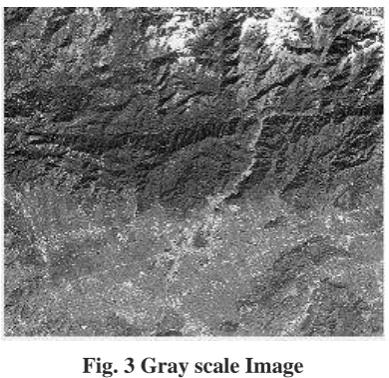
from high resolution Satellite images. In Pre-Processing, Multispectral image is converted in to Gray scale image which eliminates hue, saturation information while retaining the luminance.
Fig. 3 Gray scale Image
Apply wiener filter to the image which for removing adaptive noise and produces an estimate of a desired or target random process by linear time-invariant filtering of an observed noisy process. The Wiener filter
minimizes the mean square error between the estimated random process and the desired process. The wiener
Filter has a variety of applications such as System Identification, Noise Reduction, and Signal Detection.
5.2 Gray Level Co-occurrence Matrix
In statistical texture analysis, texture features are computed from the statistical distribution of observed
combinations of intensities at specified positions relative to each other in the image. According to the number of
intensity values of the pixels in each combination, statistics are classified into first-order, second-order and
higher-order statistics. The Gray Level Co-occurrence Matrix (GLCM) method extracts second order statistical
texture features. The approach has been used in a number of applications, Third and higher order textures
consider the relationships among three or more pixels.
`1358 |
P a g e
Neighbour pixel value
Ref pixel value:
0
1
2
3
0
0,0
0,1
0,2
0,3
1
1,0
1,1
1,2
1,3
2
2,0
2,1
2,2
2,3
3
3,0
3,1
3,2
3,3
A GLCM is a matrix where the number of rows and columns is equal to the number of gray levels, G, in the
image. The matrix element P (i, j | Δx, Δy) is the relative frequency with which two pixels, separated by a pixel distance (Δx, Δy), occur within a given neighborhood, one with intensity „i‟ and the other with intensity „j‟. The
matrix element P (i, j | d, ө) contains the second order statistical probability values for changes between gray levels „i‟ and „j‟ at a particular displacement distance d and at a particular angle (ө). Using a large number of intensity levels G implies storing a lot of temporary data, i.e. a G × G matrix for each combination of (Δx, Δy)
or (d, ө). Due to their large dimensionality, the GLCM‟s are very sensitive to the size of the texture samples on which they are estimated. Thus, the number of gray levels is often reduced.
5.3 Entropy
Entropy shows the amount of information in the image that is needed for the image compression. Entropy
measures the loss of information or message in a transmitted signal and also measures the image information.
5.4 Energy
Energy provides the sum of squared elements in the GLCM. Also known as uniformity or the angular second
moment. Angular Second Moment is high when image has very good homogeneity or when pixels are very
similar
5.5 Correlation
Correlation-Measures the joint probability occurrence of the specified pixel pairs.
5.6 Contrast
`1359 |
P a g e
5.7 Inverse Difference Moment
Inverse Difference Moment (IDM) is the local homogeneity. It is high when local gray level is uniform and
inverse GLCM is high. IDM weight value is the inverse of the Contrast weight.
The results of feature extraction methods are:
Fig 4. GLCM Calculation
5.8 Feature Selection Process
The reduced Principal Components are then sorted in ascending order. The reduced matrix of PCA features has
been arranged as
PC1 ≥ PC2 ≥ PC3 ………… ≥ PCN
Principle component and N is the number of features for an image. Left side of the matrix contains most
significant features and right side of the matrix has least significant features after PCA calculation. Least
important features can be useless as these hold very fewer information and have no impact on precision.
Features on the left side hold more important information because left side of the matrix having very high
variation. The aim of our research is to choose smallest amount of features that can give best precision. At last,
from PCA features we have selected first L columns of matrix M. Though, we have chosen first few columns of
PCA reduced feature that have high variations.
PC1 ≥ PC2 ≥ PC3 ……… ≥ PCL
L is the number of columns in above equation. The results of feature selection calculation are
`1360 |
P a g e
VI. CONCLUSION & FUTURE ENHANCEMENTS
The basic elements of an object-oriented approach are image objects. Image objects are contiguous regions in an
image. Image objects can be linked to a hierarchical network, where they are attributed with a high-dimensional
feature space.Segmentation parameters for multi resolution segmentation are: scale, color, shape, compactness,
smoothness. Now, features in the ASTER image are extracted with the help of GLCM and PCA. It reduces the
essential features of objects of interest. Furthermore, this method results efficient retrieval of object properties
from the image. Further it will be applied to the object oriented segmentation and classification techniques to
extract the objects of interest. Object based classification was performed as the multi scaled, and fully functional
application. It is not directly access the single pixels if the segmentation will produce the accurate result means
the classification performance is automatically increase. The main advantage of using object based classification
it gives better performance than the pixel-based classification.
REFERENCES
[1] A Canada centre for remote sensing, Fundamentals of Remote Sensing,Natural Resources Ressources
naturelles Canada,.
[2] Tzong-Dar Wu, M. T. Lee, Geological lineament and shoreline detection in SAR images. IEEE 2007, 1-4244-1212-9/07.
[3] Thomas M. Lillesand, Ralph W. Kiefer and Jonathan W. C., Remote sensing and image interpretation,
Wiley, 2004, pp. 663-666.
[4] El Hadani, D., Remote Sensing and Geographic Information Systems for the management and water
research. Geo-Observer. The Thematic Report, 1: 28, 1997
[5] Amina Kassou, Ali Essahlaoui and Mohamed Aissa., Extraction of Structural Lineaments from Satellite
Images Landsat 7 ETM+ of Tighza Mining District (Central Morocco).
[6] D Chutia and DK Bhattacharyya., An efficient approach for extraction of linear features from high
resolution Indian satellite imageries, Vol. 02, No. 04, 2010, 1223-1227.
[7] Masood Azizi and Hakim Saibi., Integrating Gravity Data With Remotely Sensed Data for Structural
Investigation of the Aynak-Logar Valley, Eastern Afghanistan, and the Surrounding Area, IEEE Journal of
Selected Topics in Applied Earth Observations and Remote Sensing., 1939-1404, 2014.
[8] Fatwa Ramdani., Comparing Of Lineaments Extraction From Alos And Landsat Images For Supporting
Exploration Of Geothermal Field In Indonesia”, IEEE., 978-1-4673-1159-5/12, 2012
[9] Seyed Ahmad Meshkani , Behzad Mehrabi , Abdolmajid Yaghubpur , Mohammad Sadeghi, “Recognition
of the regional lineaments of Iran: Using geospatial data and their implications for exploration of metallic
ore deposits, Ore Geology Reviews 55 (2013) 48–63.
[10]M. Al Saud.,Using ASTER Images to Analyze Geologic Linear Features in Wadi Aurnah Basin, Western
Saudis Arabia.
[11]Kocala, H. S. Duzgunb, C. Karpuza., Discontinuity mapping with automatic lineament extraction from high
resolution satellite imagery
[12]Maged Marghany and Mazlan Hashim., Lineament mapping using multispectral remote sensing satellite
`1361 |
P a g e
[13]Mohamed Ali David Clausi.,Using the canny edge detector for feature extraction and enhancement ofremote sensing images
[14]Aron karnali,Amon Meisels,Leonid Fisher and Yaacov Arkin., Automatic Extraction and evaluation of
geological linear features from digital remote sensing data using a Hough transform
[15]P.Mohanaiah,P.Sathyanarayanana,L.Gurukumar. Image Texture Feature Extraction Using GLCM
Apporach” International Journal of Scientific and Research Publications,Volumne 3,Issue 5,May 2013.
[16]Miroslav BENCO,Robert HUDEC.,Novel Method for Color Texture Features Extraction Based on GLCM,
Dept. of Telecommunications, University of Žilina, Univerzitná 8215/1, 010 26 Žilina, Slovak Republic.
[17] Abdolvahab ehsanirad and Sharath kumar y. h., Leaf recognition for plant classification using GLCM and
PCA methods, Department of Computer Science, University of Mysore, Mysore - 570 006, India.
[18] Aruna ,B.Sashi Kanth,M.Harsha vardhan, CS S.Visweswara .,GLCM Architecture For Image Extraction”,
IJARECE Volume 3, Issue 1, January 2014.
[19]M. Kumar , R.K.Singh , P.L.N.Raju , Y.V.N.Krishnamurthy., Road Network Extraction from High
Resolution Multispectral Satellite Imagery Based on Object Oriented Techniques
[20]T.Kavzoglu, M.Yildiz., Parameter-Based Performance Analysis of Object-Based Image Analysis Using
Aerial and Quikbird-2 Images. ISPRS Annals of the Photogrammetry, Remote Sensing and Spatial
Information Sciences, Volume II-7.
[21]Edet A, Okereke C, Teme C, Esu O. Application of remote sensing data to groundwater exploration: a case
study of the Cross River State, south-eastern Nigeria. Hydrogeol J 1998; 6: 394-404
[22]R.E. Haralick, K. Shanmugam, I. Dinstein, Textural Features for Image Classification, IEEE Transactions
on Systems, Man and Cybernetics, Vol. SMC-3, No. 6, Nov 1973
[23]L. Cordell, Gravimetric expression of graben faulting in Santa Fe Country and the Espanola Basin, New
Mexico, in Proc. 30th Field Conf. New Mexico Geol. Soc. Guidebook, 1979, pp. 5964.
[24]M. A. Arisoy and U. Dikmen, Edge detection of magnetic source using enhanced total horizontal derivative
of the tilt angle, Bull. Earth Sci. Appl. Res. Centre Hacettepe Univ., vol. 34, no. 1, pp. 73–82, 2013.
[25]P. M. Mather, Computer Processing of Remotely-Sensed Images: An Introduction, 3rd ed. Hoboken, NJ, USA: Wiley, 2004, 442pp.
[26]Y. Li and D. W. Oldenburg, 3D inversion of gravity data, Geophysics, vol. 63, no. 1, pp. 109–119, 1998. [27]Lahti and T. Karinen, Tilt derivative multiscale edges of magnetic data,” Lead. Edge, vol. 29, pp. 24–29,
2010, doi: 10.1190/1.3284049.
[28]H. L. Zhang, D. Ravat, Y. R. Marangoni, and X. Y. Hu, NAVedge: Edge detection of potential-field
sources using normalized anisotropy variance, Geophysics, vol. 79, no. 3, pp. J43–J53, 2014, doi: 10.1190/GEO2013-0218.1.
[29]Thomas M. Lillesand, Ralph W. Kiefer and Jonathan W. C., Remote sensing and image interpretation “, Wiley, 2004, pp. 663-666.
[30]Brandt Tso and Paul Mather.,”Classification methods for remotely sensed data”, London ; New York : Taylor & Francis, 2001.
[31]Touzi, R., Lopes, A. and Bousquet, P., A statistical and geometrical edge detector for SAR images, IEEE
`1362 |
P a g e
[32]G. Olivier and R. Philippe, On the bias of the likelihood ratio edge detector for SAR images, IEEETransaction on Geoscience and Remote Sensing, Vol.38,No.3,May 2000
[33]William K. Pratt, Digital Image Processing, John Wiley & Sons, Inc, 2001, pp. 443-508.
[34] D. A. Clausi, An analysis of co-occurrence texture statistics as a function of grey level quantization, Can. J.
Remote Sensing, 28(1), 45-62, 2002.
[35] L. K. Soh and C. Tsatsulis. Texture Analysis of SAR Sea Ice Imagery Using Gray Level Co-Occurrence
Matrices. In IEEE Transaction on Geoscience and Remote Sensing, 37(2), (1999).
[36]Mavrantza, O. D. and Argialas, D. P.: Object-oriented image analysis for the identification of geologic
lineaments, International Archives of Photogrammetry, Remote Sensing and Spatial Information Sciences XXXVI (4/C42), 2006.
[37]Marpu, P. R., Niemeyer, I., Nussbaum, S., and Gloaguen, R.: A procedure for automatic object-based
classification, in: Object- Based Image Analysis, Springer, 169-184, 2008.
[38]Quackenbush, L. J.: A review of techniques for extracting linear features from imagery, Photogramm. Eng. Rem. S., 70(12), 1383–1392, 2004.
[39]William K. Pratt, ”Digital Image Processing”, John Wiley & Sons, Inc, 2001, pp. 443-508.
[40]G.J. Hay, G. Castilla., Object-Based Image Analysis: Strengths, Weaknesses, Opportunities And Threats
(SWOT), The International Archives of the Photogrammetric, Remote Sensing and Spatial Information Sciences OBIA, 2006.
[41]Nikhil K, Selva Ganesh.K, Sukumar.M, Evaluating Various Filtering Techniques on Fingerprints Matching
Using Minutiae Mapping Score, International Journal of Emerging Technology & Research, Vol 1, Issue 4, May-June 2014.
[42]Sukumar M, Venkatesan N, Nelson Kennedy Babu C, A Review of Various Lineament Detection