Abstract—The goal of this work is to create a web GIS prototype for geospatial information of Bhopal city and providing some functionality which is present in interactive web GIS application like pan, zoom, and basic query evaluation. Further the basic functionality also extended with the help of POSTGIS database and OpenLayers libraries. Geoserver was customized to set up and enhance the website functions. In this work a mechanism for restricting access to the website was implemented and examined, various advanced queries using PostgreSQL were developed and tested. Furthermore, a methodology, using combined vector analysis, was developed to deal efficiently with multi-layer overlay analysis. The facility to generate detailed information report about the queried features using the interactive interface has also been implemented.
Index Terms— WebGIS, Land Information System, PostGIS, Geoserver.
I. INTRODUCTION
GIS (Geographical Information System) is a computer system that is used to capture, store, manipulate, manage all format of geospatial data [9]. GIS has the capability to integrate spatial as well as non-spatial data and also has the ability to use different formats of data [1]. GIS has capabilities to integrate database, statistics, remote sensing, maps with advance graphics for visualization and analysis Spatial database such as land use, soil, rainfall, geology, transportation, topography, demography and socioeconomic may be implemented for better decisions in resource or facilities planning and management [4].
Land record is originated from Mughal period, later during British period scientific cadastral surveys were conducted to determine boundaries and extent of each individual landholding and to the fertility of different soils. Now –a- days the land information in india is maintained at Tulak offices. Map data is stored in Field measurement book (FMB), Jamabandi, Khasra Girdawari, Padigree Sheets etc. and land ownership detail is maintained using various registers [5]. Updating and searching for any land information in this type of system is very tedious work.
Government of India has started project National Land Records Modernization Programme (NLRMP) to update their Land information using GIS. This program is started in
Manuscript received Oct 15, 2011.
Amit Kumar, Haryana Space Application Centre, CCS HAU Campus, Hisar, Haryan, India., (e-mail: [email protected]).
Pankaj Singh Diwakar, GIS Dept.,MANIT Bhopal, M.P., India , (e-mail: [email protected]).
August 2008 by government of India aimed to modernize management of land records, minimize land disputes, and enhance transparency in land record management system [6]. In recent years, internet has become the dominated infrastructure for delivering information to users. Using the internet infrastructure, the Web GIS technology quickly gain its popularity thank to the capability to deliver both spatial and attribute data. Web GIS is used in most of the land information delivery services.
Web GIS became a economical and effort less way of disseminating geospatial data and processing tools [2]. Web mapping improves communication with the help of users who understand maps and it the easiest way to improve the internal and external communication [3]. Web GIS provides user an online platform to publish their geospatial data so that it can be accessed by other GIS users worldwide and also provides a platform to manage geospatial data in rapid and effective manner. Popularity of Web based GIS is increasing day by day, this can be seen by recognition of Google maps, Bing maps and other Web based map providers. Different web based application programming interface (AJAX, java, Flesh etc.) provides libraries and functions to generate maps in GIF, PNG, JPEG, SVG (Scalable Vector Graphic) and other formats. Open Geospatial Consortium (OGC) also provides various standard interfaces for sharing and interoperability among web-based GIS systems, GML resolve the problem of interaction between various GIS formats.WMS (Web Map Service) interface provides a simple HTTP interface for requesting geo-registered map images from one or more distributed geospatial databases [1],[7],[8].
The commercial web GIS software packages like ESRI ArcIMS and Geomedia Web Maps are also available in market, but some other open source Web GIS server and software are also available like Geoserver and Mapserver that can also be used to publish the geospatial data on internet. In this research work Geoserver is used that is very flexible and have very interactive user interface. This paper introduces an alternative approach to publish land information using open source softwares and libraries like QGIS, OpenLayers, wamp server, Geoserver, postgresql. Post GIS is spatial extension of Postgesql used to store geospatial information (shape files) in tabular form.
Web GIS based Land information System for
Bhopal City using open Source Software and
Libraries
International Journal of Science, Engineering and Technology Research (IJSETR), Volume 4, Issue 1, January 2015
II. MATERIAL AND METHODOLOGY A. Study Area
Bhopal is the capital of the Indian state of Madhya Pradesh. All administrative headquarters of Bhopal district and Bhopal division are present at Bhopal City. Bhopal is one of the greenest cities in India, it is also known as City of Lakes. Study area lies between Longitude 77.20878 E to 77.59275 E., Latitude 23.07362 N to 23.37713 N. Graphical representation of study area is given in figure 1.
Fig.1 Study area B. Data Used
LISS IV image with 5 meter resolution and fused with CartoSat pan with 2.5 meter image with Longitude 77.20878 E to 77.59275 E., Latitude 23.07362 N to 23.37713 N.
Existing Maps of Bhopal City.
Google Hybrid layer by OpenLayers plug- Ins QGIS.
C. Methodology
The methodology followed in the present study for the development of Web GIS based Land information System for Bhopal City is given in figure 2.
Whole system was designed using three tier architecture which contains 3 layers
1. Client Layer 2. Application Layer 3. Database Layer
Client Layer contains web pages which are designed using
HTML, AJAX and Java Script and OpenLayers. Application Layer has 2 servers, Wamp server which handles HTTP requests and second is Geoserver which handles map requests by client layer. Third layer is Database Layer which contains all shape files which are converted in tabular form using PostGIS extension of PostgreSQL.
Fig.2 Flow chart for Methodology
D. Digitization of Existing Maps
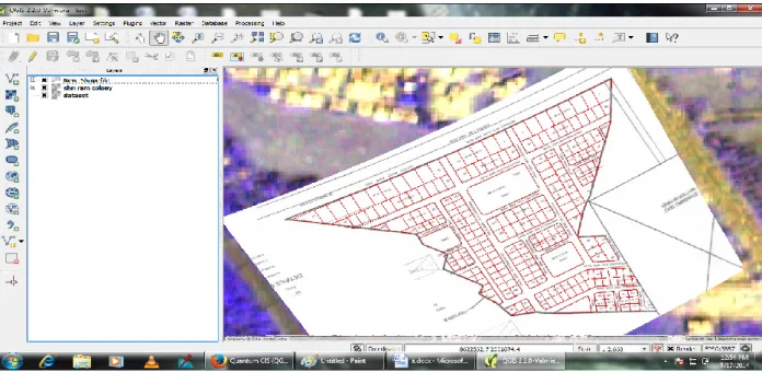
The existing maps and LISS-IV satellite image geo-referenced with Dual frequency Differential-GPS Ground Control Points (GCPs). Existing maps are digitized using QGIS. All information related to shape file are stored in attribute table of the shape file as shown in figure 3 and 4. These are 5 shape files which were created for this research work (road, railway, land, and natural_land and points). Land shape file containing the details of colony houses and their attribute information like land_id, owner_Name, area, address etc.
E. Importing Shape Files to Spatial Database
Shape file imported into PostgreSQL in tabular form using „Shape File to PostGIS Importer‟ as in figure 5. After importing all the shape files using PostGIS importer data was saved into PostgreSQL in tabular form and a spatial database was created. Now PHP (Server side programming language) can directly interact with PostgreSQL tables and data can be fetched, inserted and updated using database queries.
GIS Server Web Server Database Layer Application Layer Client Layer
All shape files are imported in PostGIS by POSTGIS shape file and dbf loader
Other login, role and role permission tables
Web browser and other client applications Spatial database contain
shape file in tabular form.
GIS Layers (Land record, Natural places, Roads,
Fig. 3 Digitization of Existing map using satellite image
Fig. 4 Overlapped on Google satellite image.
International Journal of Science, Engineering and Technology Research (IJSETR), Volume 4, Issue 1, January 2015
F. WEB MAP SERVICES (WMS)
WMS provides a simple HTTP interface for requesting geo-registered map images from one or more distributed geospatial databases. A WMS request defines the geographic layer(s) and area of interest to be processed. The response to the request is one or more geo-registered map images (returned as JPEG, PNG, etc) that can be displayed in a browser application. A special OpenLayers function OpenLayers.Layer.WMS( ) is used to publish geospatial data on the web. Some other database tables are used for special purposes like login information, user management, role management, role permission management. These tables are integrated with map so that security can be maintained in terms of web GIS portal.
G. Software and libraries Used
QGIS is an open source GIS software that is used to digitize map and it can also import and export data directly from POSTGIS and GeoServer.
PostgreSQL and POSTGIS is used for data storage like user login details, user permission detail, and all the vector files are also stored using POSTGIS extension of PostgreSQL software, it is open source software that handles almost all kind of vector data and raster data format.
Wamp server is also open source software that is used to handle HTTP request made by client and after manipulation of data by server side scripting language and it gives response back to the client in the form of HTTP response.
GeoServer handles geospatial request of clients. Java provides run time environment for the GeoServer. This server takes WMS request from webserver and responds with WMS response.
PHP is used for server side scripting language, PHP code handles all the requests made for the server and manipulates data according to user‟s requirement. It can handle dynamic request of data from database and it can easily interact with PostgreSQL.
OpenLayers library makes it easy to put a dynamic map in any web page. It can display map tiles and markers loaded from any source. OpenLayers has been developed to further the use of geographic information of all kinds. OpenLayers is completely free and Open Source Java Script library .Web pages are designed in HTML language and Java Script event.
III. RESULTS A. Online Visualization of Shape Files
There are some main functionalities of this geospatial web portal which are given below
Search can be performed on the map layer wise and result is shown in geographical form.
Pan and zoom tool gives facility to handle zoom level and handling map.
Layer Selection Panel gives facility to select and deselect the layer.
Main web page shows different shape files on the map in different layers.
Login panel gives access to authorized user to modify map data.
Webpage showing the shape files of Bhopal city area is shown in figure 6.
B. Searching in Map
When we put some text in the search box and select layer then this text is compared with the database of shape file that is stored in PostgreSQL database in tabular form and a spatial attribute in table store geometry information, then this column of the table is used by the OpenLayers java script library to display data in the map. The result of search is highlighted by red color boundry or by marker. This helps up to find particular land parcel or location on the map as shown in figure 7.
C. Measuring Distance and Area on Map
We can measure distance as well as area on the map, the line drawn on the map as shown in figure 8 and circle inset shows the area of the polygon in square meter. Distance can also be calculated on the map using „Measure the distance‟ option. The option named as „Right time measurement result on mouse over‟ calculates distance or area as we move over mouse to draw polygon or drawing a line.
D. Getting Detail of Feature on Map
Users can get the information of particular land parcel of land or other feature e.g. details of the road. By single click on the feature user can get all the information related to feature in a pop up window. Openlayers provides GetFeatureInfo() function in WMS so that we can get information related to particular feature. As we can see in the figure 9 given below that when we click on the land parcel we get information related to parcel like land_id, area, owner_name etc. (attributes data stored in the database in tabular form).
Fig.6 Main Web page for Land information system portal of Bhopal City
Fig.7 Search result by using searching tool
International Journal of Science, Engineering and Technology Research (IJSETR), Volume 4, Issue 1, January 2015
Fig.9 Detail of the feature E. Login Window for Authorized Access
For customization and modification of the data, for creating new user, a separate webpage is designed as shown in figure 10. Whereas for secure access a login panel is provided, when user fills the details like username and password and press „Sign In‟ then, login detail is compared with detail presents in database, if user is not authorized then it shows a warning message.
Fig.10 Detail of the feature F. Customization Option
There are some facilities which are provided for the administrator to make new user, prepare report and update data. Administrator can give permission to new user. User Management, Statistical Report and Update map data section for the customization options which is shown in figure 11.
The main points of User Management option are given as follows: Adding new Users
Adding User group Update user group
Fig.11Customization option for administrator section
G. Updating Existing Information in Geo-database and Report Generation
If user wants to update owner name of a land parcel then this web GIS portal gives a facility to update owner name. Only those users can update existing details that have authority to update information. Furthermore, user can also print the status report generated about land data.
ACKNOWLEDGMENTS
We are very thankful to Mr. Nhã Hoàng Đức and Dr. S. K. Katiyar for their technical support. I am also thankful to MANIT Bhopal for providing us literature and Lab facilities.
REFERENCES
[1] Nutan Tyagi, “Web GIS application for customized tourist information system for Eastern U. P., India” Indian Society of Geomatics, Vol 8 No. 1, pp.1-6, April 2014.
[2] A. Alesheikh, H. Helali, and H.A. Behroz, “Web GIS Technologies and its applications Symposium on Geospatial theory”, Ottawa Toosi University of Technology, pp 2-3, 2002.
[3] S. Stachowicz, “Geographical data sharing – advantages of web based technology to local government 10th EC GI & GIS Workshop, ESDI State of the Art, Warsaw, Poland, pp 1-2, June 2004.
[4] W.T. Lin, H.Y. Fong, S. Ming, “GIS for Irrigation Management in Irrigation Associations”, National Taiwan University, Taipei, pp. D1-71, 2004.
[5] A. Mishra, D. J. Pal, “Land Record Information Management System (LRIMS) – A Conceptual Framework”, Map India 2000 Conference, April 2000.
[6] http://nlrmp.nic.in
[7] M.H. Tsou, B.P. Buttenfield, “A Dynamic Architecture for Distributed Geographic Information Services”, Transactions in GIS. 6(4), pp. 355-38, 2002.
[8] Open GIS Consortium. OpenGIS implementation specification for geographic information - simple feature access - part 1: common architecture. 2006.
[9] Geographic Information Systems as an Integrating Technology: Context, Concepts, and Definitions". ESRI. Retrieved 9 June 2011. [10] J. Sarup, V. Shukla, “Web-Based solution for Mapping Application
using Open-Source Software Server”, International Journal of Informatics and Communication Technology, pp. 91-99, December 2012.