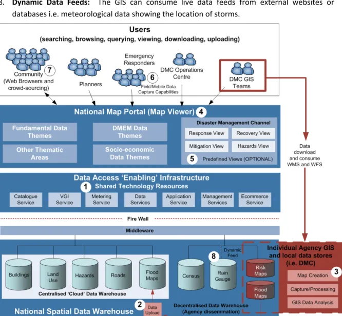
SRI LANKA SPATIAL DATA INFRASTRUCTURE ROAD MAP
Full text
Figure


Related documents
Wireless Configuration Utility Wireless Setup Utility Wireless mode Wireless router router WLAN Wireless Local Area Network.
System Model: While they might be different in purpose and technique, most active end-to-end measure- ment tools share a similar system model consisting of a verifier and a
Keywords: Operating room crises, Cognitive aids, Crisis checklists, Emergency manuals, Implementation of innovations, Organizational context, Implementation process,
Bertelsmann Stiftung (2010), in their comprehensive study of leadership development best practices, suggested that in the future, organizations could choose to invest their
For further information regarding speech-language-hearing services for individuals with brain injury, contact the American Speech-Language and Hearing Association, 10801 Rockville
With the Chinese case in mind, we assume that a country that creates a basket currency chooses the weights of component currencies so as to stabilize the trade balance
As you may recall, last year Evanston voters approved a referendum question for electric aggregation and authorized the city to negotiate electricity supply rates for its residents
AM/FM CD player, MP3/WMA playback capability, six speakers, auxiliary audio jack, USB 2.0 port 3 with iPod ®4 connectivity and control, voice.. recognition, 5 hands-free
