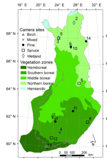
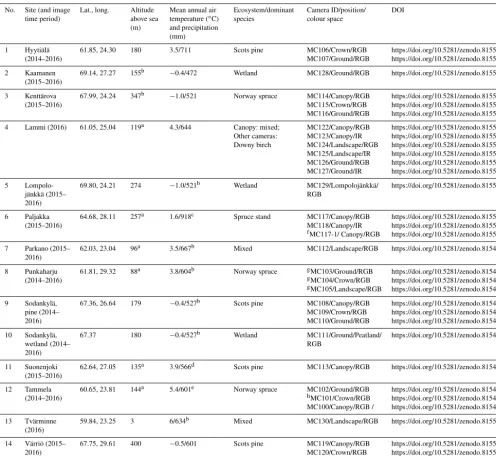
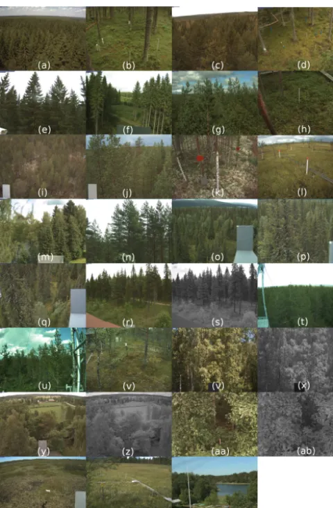
Webcam network and image database for studies of phenological changes of vegetation and snow cover in Finland, image time series from 2014 to 2016
Full text
Figure

Related documents
This essay asserts that to effectively degrade and ultimately destroy the Islamic State of Iraq and Syria (ISIS), and to topple the Bashar al-Assad’s regime, the international
Our Corporate Banking Sector delivered strong growth in 2011, with business customers showing trust in the Bank’s solid foundations and stability.. Lending to companies increased
Rather, it merely acknowledges that any conceptual mapping of the ICL field would be incomplete without featuring the prosecutors belonging to the International
19% serve a county. Fourteen per cent of the centers provide service for adjoining states in addition to the states in which they are located; usually these adjoining states have
Growth and yield of cotton in response to a free-air carbon dioxide enrichment (FACE) environment. and Forest
On their front or longitudinal sides, the bus bars 2, 3 also present connection tabs 6, 7 which are disposed such as to be also fixed to the edge of the printed circuit board1.
(Although basic math facts include addition, subtraction, multiplication, and division, this study tested multiplication only.) The students’ fluency was then related to their
