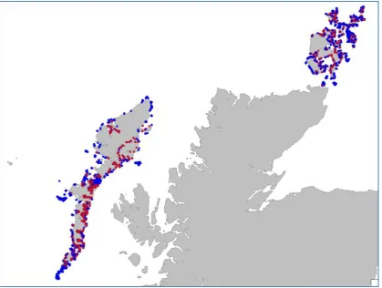
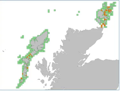
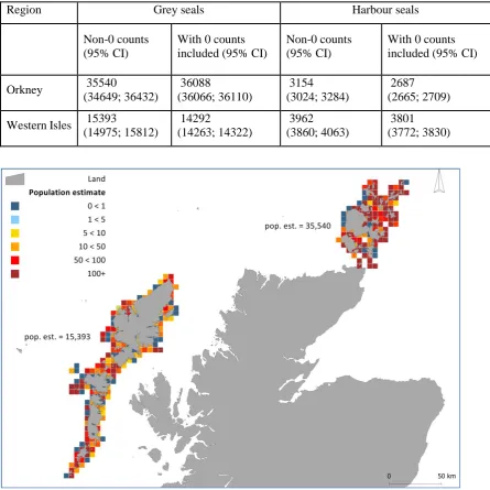
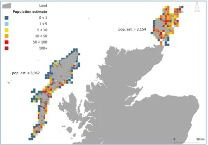
Population scaling in 5 km x 5 km grey and harbour seal usage maps Note to Scottish Government MMSS/002/15
Full text
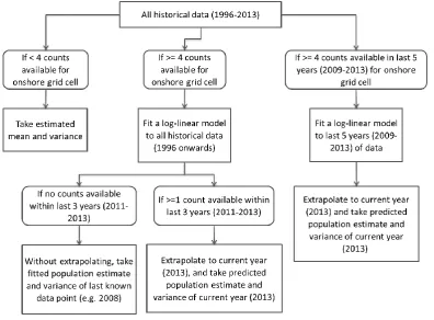
Figure
Related documents
To evaluate the applicability of the red pattern to assessing the rapidity of death, we calculated its sensitiv- ity, specificity, positive predictive value, and negative
This total includes the taxable value of homesteads with tax ceilings (will deduct in line 2) and the captured value for tax increment financing (wi l l deduct taxes
(This is analogous to the well known problem of knowledge elicitation for the development of expert systems.) In general, one needs to inventory the organization’s knowledge as well
Berdasarkan hasil wawancara dengan informan Koordinator Pengelola PKM- K dan mahasiswa penerima beasiswa Bidikmisi yang lolos seleksi PKM-K mengenai dana yang diberikan pada
Just as there is variance in the capabilities and offerings of urgent care centers, the operating model of freestanding emergency centers also varies depending on the
Marketing (including the Digital Communications Team) will work with colleagues in Schools/Faculties and professional service teams, offering advice and assistance with writing
The purpose of the proposed quantitative research study was to understand the perception of employees towards superior‟s leadership style in fostering innovation
accepted tables come from the American Nuclear Society (ANS) and the American National Standards Institute (ANSI), published in 1991. New work has been done on buildup factors
