R Script for Classifying Patterns of Urban Growth
Full text
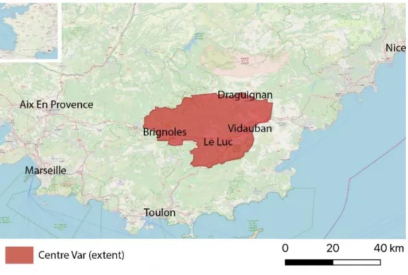
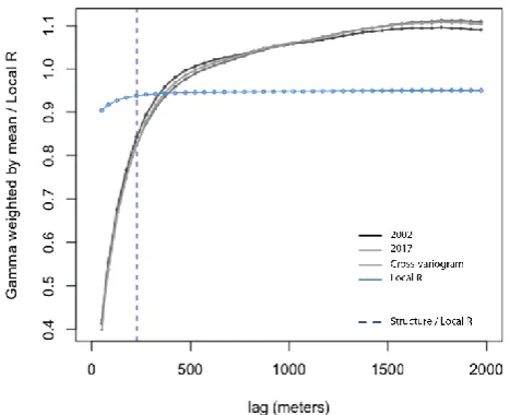
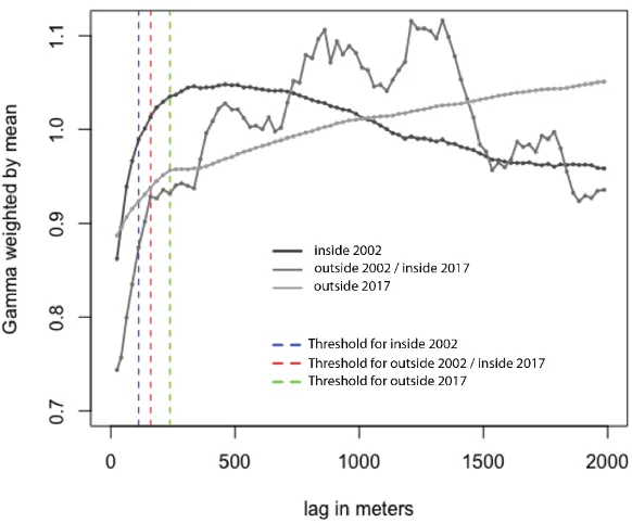
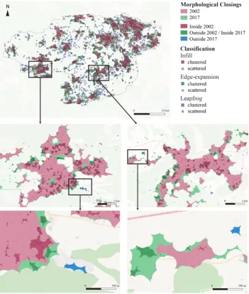
Figure
Related documents
The proposed changes to the S-101 data quality model result in a data quality model that is more generalized and can be used in common across multiple IHO product
The university provides support for special-needs students through cooperation between a vari- ety of entities, which chiefly takes the form of contact persons for
15 The merger date is the date on which the target bank loses its charter.. a merger on the change of the deposit rates by dividing the time period around the merger into
Lucrezia Bori Language Grant The Juilliard School 2006 English Teaching Fellowship The Juilliard School 2006-2007 Community Service Fellowship The Juilliard School 2006-2007
The Commonwealth Fund/ Modern Healthcare Health Care Opinion Leaders Survey was conducted online within the United States by Harris Interactive, on behalf of The Commonwealth
Doing Mad Studies: A Participatory Action Research Project to explore the experiences and impacts of being part of a Mad People’s History and Identity course and to
o Association of Christian Schools International, Preschool Conference, “PC’s for Preschoolers”, Liberty University, September 1999.. o Piedmont Area Reading Council, New
It also evaluates the survey’s usefulness as a tool for economic analysis and compares survey indexes to aggregate manufacturing data and to indexes from similar surveys conducted
