Design and Development of a Low-Cost
Multisensor Inertial Data Acquisition System
for Sailing
Radhika Jagtap1, Dr.D.G.Khairnar 2
PG Student, Dept. of E&TC Engineering, D. Y. Patil College of Engineering, Akurdi, Savitribai Phule University
Pune, India1
HOD & Professor, Dept. of E&TC Engineering, D. Y. Patil College of Engineering, Akurdi, Savitribai Phule
University Pune, India2
ABSTRACT-It represents the development of inertial measurement of data acquisition system mainly used in sailboats. Mainly it detects the location and correct inertial measurement for racing application. The variables of interest are three-axis acceleration, three-axis rotation, Global positioning system (GPS), position/velocity, Magnetic compass bearing and boat speed direction. The designs mainly focus on low cost micro-electromechanical system based technology. Also it include the novel application of MEMS (micro-electromechanical system) technology that combines computer with tiny mechanical devices such as accelerometer, gears, valves and embedded in semiconductor chips.
KEYWORDS: GPS, Gy521, Arduino, inertial measurement units (IMUs)
I.INTRODUCTION
Quantifying the motion of a vehicle is employed in numerous fields as a means to improve the underlying design, to control or use of the vehicle or their parts. For example, inertial measurement units (IMUs) have been applied to the analysis of vehicle dynamics, two wheeled vehicles, navigation for helicopter, tire deformation, navigation for land vehicles, personal dead reckoning systems, as well as navigation for submarines and tractors. IMU in aircraft measurement works with sensing motion including the types, rate and direction of the motion using a combination of accelerometers are placed such that their measuring axes are orthogonal to each other.A IMU works by detecting the current rate of acceleration as well as it changes in rotational attributes, including pitch, roll and yaws. This data is then fed into computer, which calculates the current speed and position given a known inertial speed and position.
II.LITERATURE SURVEY
In this paper they present a[1] new method for real time estimation of the sail boat polar diagrams. The idea of the algorithm is principally based on the standard procedure used to select the best route that guarantees the major boat speed during a sail competition. The method is focused on a continuous comparison of the navigation data with the optimal polar diagram computed until then. The optimal surface is real time updated if the best performances reached are overcome. The outcome is the Real Time Polar Diagram, that describe the real performance of a sailboat with more accuracy with respect to the maps provided by VPPs. INS/GPS integrated system has[2]been one of the most popular methodologies in the research field of navigation technology. This paper aims at developing a real-time low-cost INS/GPS integrated navigator based on PC platform and reviewing many problems encountered in the development of real time system. A MEMS IMU is applied in the system to meet the requirements of low cost and small size. The preliminary results illustrates the proposed system with frequent ZUPT/ZIHR provides a stable performance operating kinematically in free inertial mode without the aiding of GPS by 15 minutes with a low-cost IMU and the INS/GPS integrated solutions are improved by 50% when automatic ZUPT/ZIHR and NHC are applied in GPS denied areas. Ship provides an attractive platform [3] from which high-frequency meteorological observations (e.g., wind components, water vapour density, and air temperature) can be made accurately.
However, accurate observations of meteorological variables depend on removal of ship- motion contaminations and appropriate placement of sensors onboard. Vertical and lateral wind components suffer more disturbances than longitudinal wind in consequence of ship motion. Wind stream approaching towards bow gets deflected due to the presence of ship’s superstructure that causes error in the wind measurements. Mean wind speed reduction of ~ 8.5% were estimated due to the cylindrical mast when wind flows was parallel to the horizontal plane and excess of ~9% for the wind flow normal to the plane. It has been observed that the effect of flow distortion on wind is less for relative wind direction of ±45 degree relative to the major axis of the ship [2]. This thesis presents [4] the design of an inertial measurement data acquisition system intended for use in sailboats. The variables of interest are 3-axis acceleration, 3-3-axis rotation, GPS position/velocity, magnetic compass bearing and wind speed/direction. The design focus is on low-cost micro-electromechanical systems (MEMS) based technology and demonstrating the validity of these technologies in a scientific application. A prototype is constructed and submitted to a series of tests to demonstrate functionality and soundness of the design.
These tests range from bench tests to full scale application. The integration of an Inertial Navigation System (INS)[5]and the Global Positioning System (GPS) is common in mobile mapping and navigation applications to seamlessly determine the position, velocity, and orientation of the mobile platform. In most INS/GPS integrated architectures, the GPS is considered to be an accurate reference with which to correct for the systematic errors of the inertial sensors, which are composed of biases, scale factors and drift. However, the GPS receiver may produce abnormal pseudo-range errors mainly caused by ionospheric delay, troposphere delay and the multipath effect. These errors degrade the overall position accuracy of an integrated system that uses conventional INS/GPS integration strategies such as loosely coupled (LC) and tightly coupled (TC) schemes.To avoid this problem, a new integrated INS/GPS architecture is proposed. The proposed method is described and applied in a real-time integrated system with two integration strategies, namely, loosely coupled and tightly coupled schemes, respectively. To verify the effectiveness of the proposed method, field tests with various scenarios are conducted and the results are compared with a reliable reference system.
III.METHODOLOGY
It shows the data acquisition system. it includes multi-MEMS sensor like accelerometer, gyroscope, magnetic compass also it contain GPS, LCD display, GPRS modem and controller. Arduino interface with MEMS GY521 which include
accelerometer (ADXL345), gyroscope (L3G4200D), magnetic compass (MC5883L), all this sensors interconnect on
Fig.1: System block diagram
Accelerometer are highly sensitive component of inertial navigation system for sailboats, it can detect the motion and change the speed of boat according to it. Gyroscope is used to detect the angular motion: tilt of the boat and magnetic compass shows the direction of boat. GPS trace he location of boat in terms of lagititude and latitude. PC communicates to controller with GPRS. Also PC has processing window in which data will differentiated and process. Connection can make and break using socket programming. Generally it gives the 5 parameter as speed, location, altitude, tilt and angular motion. Finally all this data fed to the Android app through IoT.
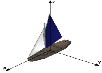
An Inertial Measurement Unit (IMU) is a device which quantifies the motion of an object as it moves about the Earth. The can be used either as information gathering devices or for control of the object. Inertial measurement is in itself usually accomplished by measuring accelerations or velocities, either linear or rotational. Since the world exists in a three dimensional space, linear acceleration is, by convention, measured on three linearly independent orthogonal axes based on the Cartesian coordinate system. On ground based moving vehicles, X-direction is typically oriented forwards, Z-direction is typically upwards and Y-axis towards the left hand side when facing forwards as shown in Figure 3. Further details on the conventions used to describe the orientation of a rigid body in a three-dimensional space.
Fig.2: Typical Body Frame Axes for Ground Vehicle
which provide an indication of the orientation of the Earth‘s magnetic field. These function like a traditional needle compass, “pointing” North. Another very powerful technological advance that is becoming omnipresent in inertial measurement is global positioning system technology, or GPS. This technology is based on a constellation of satellites orbiting the planet which provide signals that can be used by a receiver to triangulate position along the surface of the Earth. GPS devices also supply heading and speed while underway and are generally regarded as having good accuracy.
1. GPS skg13bl (Global Positioning System)
The SKG13BL is a complete GPS engine module that features super sensitivity, ultra low power and small form factor. The GPS signal is applied to the antenna input of module, and a complete serial data message with position, velocity and time information is presented at the serial interface with NMEA protocol or custom protocol. It is based on the high performance features of the Media Tek MT3337 single-chip architecture, Its –165dBm tracking sensitivity extends positioning coverage into place like urban canyons and dense foliage environment where the GPS was not possible before. The small form factor and low power consumption make the module easy to integrate into portable device like PNDs, mobile phones, cameras and vehicle navigation systems.
Fig.3: GPS skg13bl
2. Arduino Uno
Arduino Uno is a microcontroller board based on the ATmega328P. It has 14 digital input/output pins (of which 6 can be used as PWM outputs), 6 analog inputs, a 16 MHz quartz crystal, a USB connection, a power jack, an ICSP header and a reset button. It contains everything needed to support the microcontroller; simply connect it to a computer with a USB cable or power it with a AC-to-DC adapter or battery to get started.. You can tinker with your UNO without worring too much about doing something wrong, worst case scenario you can replace the chip for a few dollars and start over again.
3. MPU 6050(Gy521)
The MPU-60X 0 Motion Tracking devices, with its 6-axis integration, on-board Motion Fusion TM, and run-time calibration firmware, enables manufacturers to eliminate the costly and complex selection, qualification, and system level integration of discrete devices, guaranteeing optimal motion performance for consumers. The MPU-60X0 is also designed to interface with multiple non-inertial digital sensors, such as pressure sensors, on its auxiliary I C port. The MPU-60X0 is footprint compatible with the MPU-30 X 0 families. The MPU-60X0 features three 16-bit analog-to-digital converters (ADCs) for digitizing the gyroscope outputs and three 16-bit ADCs for digitizing the accelerometer outputs. For precision tracking of both fast and slow motions, the parts feature a user-programmable gyroscope full-scale range of ±250, ±500, ±1000, and ±2000°/sec (dps) and a user-programmable accelerometer full-full-scale range of ±2g, ±4g, ±8g, and ±16g.
4. ADXL:
The ADXL335 is a complete 3-axis acceleration measurement system. The ADXL335 has a measurement range of ±3 g minimum. It contains a polysilicon surface-micro-machined sensor and signal conditioning circuitry to implement open-loop acceleration measurement architecture. The output signals are analog voltages that are proportional to acceleration. The accelerometer can measure the static acceleration of gravity in tilt-sensing applications as well as dynamic acceleration resulting from motion, shock, or vibration.
IV.RESULT
Fig.6: Simulation Result
V.CONCLUSION
In this paper the problem of estimation of the best performance of a sailboat is tackled in a real-time Framework. A new algorithm is introduced to real-time data capture and updating of the best Performance of a sail ship. The presented method improves the polar diagrams accuracy and
provides a real-time feedback of how far the boat speed is from the target. The main Sensors advantage of the proposed system is that it can detect and eliminate abnormal GPS measurements, mainly caused by the multipath effect, thus improving the overall performance of the integrated
System. This system developed for accurately detects the angle by considering all parameter by using this system to avoid the accident. This technique automatic works efficiently as compare to old technique.
REFERENCES
1. S. Corbetta, I. Boniolo, S. M. Savaresi, S. Vischi, A. Strassera, and D. Malgarise, “Real-time identification of the best performances of a sailboat,” in Proc. ACC, 2012, pp. 4941–4946..
2. M. Cai, “Performance evaluation of real-time MEMS INS/GPS integration with ZUPT/ZIHR/NHC for land navigation,” in Proc. 12th Int. Conf. ITST, 2010, pp. 584–588.
3. Vijay Kumar, Sadashiv Khalap and Prakash Mehra, “Instrumentation for High-Frequency Meteorological Observations from Research Vessel”, National Institute of Oceanography, Dona Paula, Goa - 403 004, India, 2011.
4. A. Bergeron, “Design and development of a marine data acquisition system for inertial measurement in wind powered yachts,” M.A.Sc. thesis, Dept. Mech. Eng., University of Ottawa, Ottawa, ON, Canada, 2014