__________
* Corresponding author
E-mail addresses:[email protected](A.KhosraviKazazi);[email protected]
(F.Hosseinali)
DOI: 10.22059/eoge.2019.271705.104254
ABSTRACT
Due to technological developments, 3D city models have become valuable in various domains such as emergency services, facilities management, tourism and entertainment along with several applications such as the estimation of solar irradiation, routing, lighting simulations, etc. However, many cities in the world, especially in developing countries, still suffer from lack of 3D city models. It seems that the main reason for this deficiency is that 3D city models are expensive. Furthermore, acquiring semantic and thematic data as an indispensable part of 3D city models is an exhausting and time-consuming task. Nowadays, a geospatial data collecting technique, which is an inexpensive and promptness solution, has been developed. This technique is based on crowdsourcing concept and is recognized as Volunteered Geographic Information (VGI). In this paper, we have used VGI as a free and promptness technique for data gathering to solve the abovementioned problems in the Shahid Rajaee Teacher Training University as the study area. We gathered the minimum required data for creating a 3D city model based on the CityGML standard as the most well-known and acceptable standard by VGI. Also, 3DcityDB that supports CityGML was used for data storage task. In order to collect the required data, an Android mobile application was developed based on Open Data Kit (ODK). In this study, the volunteers were asked to provide their estimations of the heights of buildings as well as some other spatial and attribute data. Consequently, a 3D city model was produced based on the CityGML standard that achieved LOD 1 and 2. For validation, the heights of buildings obtained from VGI were compared to the accurately measured heights. The calculated RMSE for this comparison was 1.33 meter, proving the abilities of VGI in collecting reliable datasets.
S
KEYWORDS
3D City Model
CityGML
VGI
Open Data Kit
3D city DB
1. Introduction
The world is increasingly described in three dimensions and cities as the largest human settlements. Cities provide facilities like housing, transportation, sanitation, utilities, and communication for their growing population and expanding regions. Therefore, the creation, maintenance, and development of dynamic 3D city models with the ability of updating are of the main needs of urban planning. Today, 3D city models have been employed in several domains and for a large range of tasks.Biljecki et al.(2015) reviewed the applications of 3D city models and demonstrated that these models could be employed in at least 29 use cases that are a part of more than 100
applications (Biljecki et al., 2015). The acceptance and recognition of these models by community has led to the definition of standards that are relevant to spatial, temporal and semantic characteristics of three dimensional cities. The most popular standard in this regard is CityGML, which has been provided by the Open Geospatial Consortium(OGC). CityGML is an open data model and XML-based format for the storage and exchange of virtual 3D city models. This standard includes geometric and thematic models. The first model allows consistent and homogeneous definition of geometrical and topological properties of spatial objects within 3D city models and the second one employs the geometric model for different thematic fields such as Digital Terrain Models (DTM), sites, vegetation, water
w e b s i t e : h t t p s : / / e o g e . u t . a c . i r
Developing a VGI method for 3D city modeling based on CityGML and
Open Data Kit
Ali Khosravi kazazi, Farhad Hosseinali *
Department of Surveying Engineering, Faculty of Civil Engineering, Shahid Rajaee Teacher Training University, Tehran, Iran
Article history:
55 bodies, transportation facilities, and city furniture. Although
some standards, such as CityGML, facilitate the modeling process, there are some barriers to provide and maintain high-quality models. The most important barriers are time and cost (Ribarsky et al., 2013). On the other hand, the data contributed to the creation of a 3D model must satisfy the quality measures of spatial data. These measures are completeness, consistency, positional accuracy, temporal accuracy, and thematic accuracy, defined by International Organization for Standardization (ISO). Since the efficiency and usability of such models depend on the quality measures, therefore, the traditional data collection methods that consume time and cost are unable to acquire up-to-date datasets continually. Accordingly, governmental agencies will be attributed to new roles: they act as regulator actors instead of principal producers (Hajji & Billen, 2012).
Goodchild (2007) coined the term Volunteered Geographic
Information (VGI). A VGI system is a free of charge data gathering approach, in which volunteer citizens use their own tools (i.e., smartphones) to create, assemble and disseminate geographic information. This task is normally have formal not
do who usually by those
carried out
training in GIS or cartography, often incorporate multimedia representations, including photographs, texts, information locational
tagged with are
and sounds that
(Elwood, 2009). Nowadays, there are numerous purposes, different
with systems implemented VGI
especially those that collect global 2D and semantic information. In addition to numerous 2D VGI examples, there are several crowds generated spatial 3D information systems. The most advanced work in the context of creating 3D city models from VGI data is the Open Street Map (OSM)-3D project(Uden &Zipf, 2013). According to the increase of databases enriched by volunteered geographic information both in 2D and 3D scope, there are two ways to create a 3D city model using VGI: first exploring the existing databases and extracting useful relevant data, second, designing a new system dedicated to obtaining the required data to create a comprehensive and dynamic model. Although the first method looks possible, according toGoetz&Zipf(2012)who tried to relate OSM key/values as the largest crowd generated content of CityGML attributes, there are three different relationships between OSM key/values and CityGML attributes (Goetz & Zipf, 2012).
The acquisition of semantic information from OSM for CityGML is convenient only when one key in OSM can be mapped to one attribute in CityGML, or in other words, there is a one-to-one relationship between them. Where several OSM keys can be mapped to a single CityGML attribute or there is no suitable OSM keys for a CityGML attribute, it is complicated or almost impossible to relate OSM key/values to CityGML attributes. Thus, in order to overcome the drawbacks of the first method, it is necessary to use the second approach that is capable of designing a
new system for data gathering according to CityGML attributes. Consequently, this paper represents a new approach to acquiring CityGML attributes through a VGI system designed by the Open Data Kit (ODK). The remaining sections of this paper are organized as follows: first, a review of some related researches is presented. Afterward, the CityGML standard required for the subsequent work and discussion is described in the detail. This is followed by the introduction of 3DCityDB. Then, ODK is explained. Next, a framework for the creation of CityGML models in 3DCityDB from VGI using ODK is introduced. Finally, the last part summarizes the presented work.
2. Related Works
Generally, there are various techniques to generate 3D city models, including photogrammetry and laser scanning, extrusion from 2D footprints, synthetic aperture radar, drawings, handheld devices, and
architectural models
and volunteer modeling,
procedural ed geoinformation
(Biljecki et al., 2015). Some studies and projects have
examined generating 3D City models from volunteered geoinformation that often use OpenStreetMap as a source of information.Over et al.(2010) investigated the challenges of generating a web-based 3D city model from OSM. They reviewed the suitability and quality of the OSM data for 3D visualizations of traffic infrastructure, buildings, and points of interest. Also, based on OGC standards, they properly implemented specialized web services. Finally, they represented a service as the research results and named it OSM-3D (Over et al., 2010). Although OSM-3D is recognized as the most advanced project in this scope, it only focuses on visualization purposes, while a standardized usage for exchanging and sharing urban city models is not combined with VGI. Therefore,Goetz&Zipf
56 reduces manual labor using automating processes,
facilitates the collaborative maintenance of the models by integrating a control system, and finally reduces geometric and semantic errors through systematic and frequent execution of automatic tests.
3. CityGML
The City Geography Markup Language (CityGML) is a concept for the modeling and exchange of 3D city and landscape models issued by Open Geospatial Consortium (OGC) (Ohori et al., 2018). Over the last year, CityGML is quickly being adopted on an international level. CityGML provides a common definition of basic entities, attributes, and regulations of a 3D city model. CityGML has become a global standard for storing and exchanging 3D city models, thus allows interoperable access to 3D city models. It is based on the Geography Markup Language 3 (Lake et al., 2004), which is commonly used for exchanging data in spatial data infrastructures. CityGML not only represents the graphical appearance of city models, but it specifically thematic semantic and
of addresses the representation
aggregations. CityGML and taxonomies, properties, The models. thematic and two geometric includes
geometric model allows for the consistent and homogeneous definition of geometrical and topological properties of spatial objects within 3D city models. Spatial objects of uniform shape, e.g., trees, which appear many times at different positions, can also be modeled as prototypes and be used multiple times in the city model. A grouping concept allows the combination of single 3D objects, e.g., buildings in a building complex. Those objects that are not geometrically modeled by closed solids can be virtually sealed to compute their volumes, such as or airplane hangars tunnels,
underpasses, pedestrian
(Ozerbıl et al., 2019). Whereas geometry describes the spatial configuration of features, a thematic model describes semantic definition, attributes, and relationships of features. CityGML differentiates five consecutive Level Of Detail (LOD), where objects become more detailed with increasing LOD regarding both their geometry and thematic differentiation. CityGML files can - but do not have to - simultaneously contain multiple representations (and geometries) for each object in different LOD (Biljecki et al., 2014). The generalization of relations allows the explicit representation of aggregated objects over different scales. In addition to spatial properties, CityGML features can be assigned to appearances. Appearances are not limited to visual data but represent arbitrary observable properties of the feature’s surface such as infrared radiation, noise pollution, or earthquake-induced structural stress. Furthermore, the objects can have external references to corresponding objects in external datasets. Enumerative object attributes are restricted to external code lists and
values defined in external, redefinable dictionaries. In addition to the above-mentioned characteristics, there are several other characteristics like modularization and Application Domain Extensions (ADE), but we do not describe them because they are not further required. Nowadays, the software packages dealing with CityGML are classified in six categories namely: viewers, generators of 3D city models in CityGML, parsers and API for programmers, validators of different aspects of CityGML, software that uses CityGML as input, and the DataBase Management System (DBMS) that store CityGML data. A DBMS is a computer application that interacts with end-users, other applications, and the database itself to capture and analyze data. The final goal of this paper is the
VGI data acquir to
method
introduction of a new ing,
storage and analyzing based on the CityGML standard. Therefore, we need to use a database to store and analyze the acquired data. Until now, there are two DBMS that support CityGML standards (GeoRocket and 3DCityDB); the first is a high-performance data store for geospatial files (cloud-based); the latter is a free geodatabase to store, represent, and manage virtual 3D city models on top of a standard spatial relational database (PostGIS and Oracle). We do not merely need a repository for data storage, but we also need data management and analysis. Therefore, we will use 3DCityDB.
3.1. 3DCityDB
A 3D City Database (3DCityDB) is an Open Source package consisting of a database scheme and a set of software tools to import, manage, analyze, visualize, and export virtual 3D city models according to the CityGML standard. The database scheme results from mapping the object-oriented model of CityGML 2.0 to the relational structure of a Spatially-enhanced Relational DataBase Management System (SRDBMS). The 3DCityDB supports the commercial SRDBMS Oracle (with ‘Spatial’ or ‘Locator’ license options) and the Open Source SRDBMS PostGIS (which is an extension to the free RDBMS PostgreSQL).
and specific representation the
3DCityDB employs
processing capabilities of the SRDBMS regarding the spatial data elements. It can handle also very large models in multiple levels of details consisting millions of 3D objects with hundreds of millions of geometries and texture images.
4.Open Data Kit
Open Data Kit (ODK) is a modular, extensible, and
57
4.1.ODK Collect
ODK Collect renders forms into a sequence of input prompts that apply form logic, entry constraints, and repeating sub-structures. Users work through the prompts and can save the submission at any point. Finalized submissions can be sent to (and new forms downloaded from) a server. Currently, ODK Collect uses the Android platform, supports a wide variety of prompts(text, number, location, multimedia, barcodes), and works well without network connectivity.
4.2.ODKBuild
ODK Build is a form designer with a user-friend interface. It is an HTML5 web application and works best for designing simple forms.
4.3. ODK Aggregate
ODK Aggregate provides a ready-to-deploy server and data repository to provide blank forms to ODK Collect (or other OpenRosa clients), accept finalized forms (submissions) from ODK Collect, manage collected data, visualize the collected data using maps and simple graphs, export data (e.g., as CSV files for spreadsheets, or as KML files for Google Earth), and Publish data to external systems
(e.g., Google Spreadsheets or Google Fusion Tables). ODK Aggregate can be deployed on Google's App Engine, enabling users to quickly get running without facing the complexities of setting up their scalable web service. ODK Aggregate can also be deployed locally on a Tomcat server backed with a MySQL or PostgreSQL database.
5. CityGML data gathering by ODK
In this part of the paper, we present a structured method to provide a 3D city model using VGI. In the first step, we the CityGML considering
required data categorize the
independent purpose
a is CityGML Since
standard.
standard, it includes wide range of spatial and thematic information (Figure 2).
developed a we
this research, in
Therefore,
partial implementation of CityGML that requires the minimum data to create a 3D city model. The minimum required data are Digital Terrain Model, 2D cadastral map and buildings' elevation data, semantic and thematic information, as well as point coordinates of prototypes and texture of buildings.
Figure 1. The structure of an Open Data Kit
58 5.1. Digital Terrain Model
Recently, a new approach has been developed by Massad
and Dalyot (2018) to produce digital terrain models by
crowdsourcing of massive smartphone Assisted-GPS sensor ground observations (Massad & Dalyot, 2018). They proposed the development and implementation of a 2D Kalman filter and smoothing on the acquired crowdsourced observations for the production of topographic representation. When compared to an authoritative DTM, the results obtained are very promising in producing proper elevation values. Moreover, there are some free worldwide DTMs in different resolution provided by satellite imageries like SRTM DEM V3 (30m), ASTER GDEM V2 (30m) and USGS (30m) (Raj et al. 2018).
5.2. 2D Map
Nowadays, there are 2D maps in most urban areas in different precisions that produced by different equipment. These maps are both free of charge and priced for users. The most popular free source 2D georeferenced map is OSM. Besides, it is possible to create a system like OSM or develop OSM to acquire 2D datasets. The 2D cadastral map can be reached through drawing on georeferenced satellite imageries.
5.3. Buildings' elevation
There are two main approaches to acquire elevation data by VGI. First, we can ask volunteers to determine buildings elevation directly as OSM contributor where they specify a value for building keys (Fan & Zipf, 2016). Second, the number of levels can be asked from volunteers, then it is possible to compute the building elevation by multiplying the number of levels by an average level height
5.4. Semantic and thematic information
Detailed information on the functional, morphological, and socio-economic structure of the built environment is required for urban modeling (Kunze & Hecht, 2015). Numerous semantic information can be obtained directly or indirectly by individuals. There are three general ways of acquiring such information. The most common approach is exploiting semantic information from social networks. Geo-tagged contexts derived from social networks (e.g., Twitter, Facebook, Flickr, Instagram, etc.) can be textual, pictorial and emotional information (e.g., texts about normal life and opinion on current issues or events) provide an opportunity to conveniently and deeply explore and understand semantic information in the whole world. The second is to
process semantic information from user-generated datasets like OSM. Using innovative approaches, one can integrate some OSM keys and exploit unique semantic information from their values. The third way to collect semantic data is to use questionnaires in various scopes in an urban environment, such as transportation and traffic forecasting, urban planning, public health and safety, and emergency responses.
5.5. Prototypes
Uniform shapes like trees and other vegetation objects, traffic lights and traffic signs can be represented as prototypes that are instantiated multiple times at different locations. In order to collect prototypes coordinate data by volunteers, a simple way is using smartphones equipped with positioning sensors such as GPS.
5.6. Texture
Textures are an essential part of high-detail building
models (Uden & Zipf, 2013). There are few approaches that use crowd sourced segmented image content to build an iterative framework for 3D shape estimation. Experiments on crowd sourced image and video datasets illustrate the effectiveness of these approaches. On the other hand, re cent advances in Structure-from-Motion and Bundle Adjustment
allow to efficiently reconstruct large 3D scenes from millions of images (Untzelmann et al., 2013). The buildings can be individually reconstructed and then mapp ed into a global coordinate system by registering them to the building footprints. Moreover, according to the state-of-art, there are some solutions to generate an initial 3D shape estimation from the input videos (Ji et al., 2014).
6. Implementation
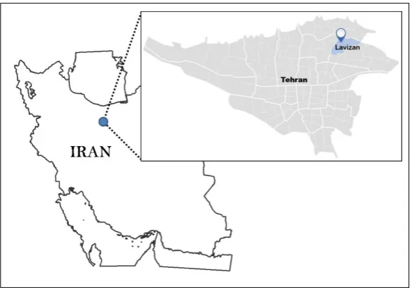
According to the previous sections, a comprehensive CityGML-based system (Shahid Rajaee University - Volunteered Geographic Information: SRU_VGI) was developed based on the ODK and its required data for 3D city modeling. This system includes three major parts: External datasets that are 2D maps. DTM, SRU collect, and SRU database.
6.1. Study Area
59
6.2. External Datasets
In this step, two free external datasets were used include 12.5m Digital Elevation Model (DEM) provided by Alaska Satellite Facility (ASF) from PALSAR satellite and 68cm
Quickbird satellite image. Figure 4(a) shows the DEM map of the study area, and Figure 4(b) shows its satellite image. Also, a 2D plan of the university was used. The plan scale is 1:500. Figure 5 shows the 2D plan of the university.
(a) DEM of the study area (b) Satellite image of the study area Figure 3. Study area
60 6.3. SRU Collect
The SRU collect is a custom development of the ODK suit. SRU collect is an Android application developed in Android Studio environment. Android API 21, camera,
compass, and global positioning system (GPS) are the required software/hardware tools for this application. Figure 6 shows two screenshot of the SRU collect app.
As mentioned before, DEM and 2D plan were collected from external datasets. However, the other required data should be collected through VGI. These datasets include absolute building level, semantic and thematic information, roof shape, geographic latitude and longitude and textures. Photograph is one of the collected datasets from which the texture of buildings is extracted. Buildings elevations are obtained from the volunteers' estimations. Furthermore, the
date, time and device serial number are saved automatically as metadata.
6.4. SRU Database
As earlier mentioned, 3DCityDB supports PostgresSQL database management systems. In this research, a custom 3DCityDB was developed based on PostgreSQL 9.4.10-64bit using the PostGIS extension. Database schemes, Figure 5. . External dataset: the 2D plan of the study area
61 relations, primary keys and foreign keys are designed based
on the above-mentioned required data for 3D city modeling.
6.5. Validation
One of the best methods to evaluate the VGI data is their comparison with formal data. Therefore, we used this method in this study. Ten buildings elevations (more than 10 percent of total buildings in the study area) were measured accurately using standard surveying methods. Then, the Root Mean squared error (RMSE) of elevation values was calculated using the following equation:
n
2
i i
i=1
1
RMSE= (Y -Y' )
n
(1)
where, Y and Y′ are accurate and estimated elevations of
building I, respectively. The number of buildings, n, is 10. The calculated RMSE value was equal to 1.33m. This value is less than the elevation of one floor. On the other hand, this is not only acceptable but an accurate value for producing a Digital Surface Model (DSM) for urban area.
6.6. Analyses and Discussion
The SRU_VGI system was applied in the study area over one month. In this period, 26 volunteers contributed to this system. The collected dataset includes about 50 percent of the buildings in the study area. Considering the CityGML theory, the minimum height precision is 5m, 2m, 0.5m, and 0.2m for LOD 0 to 4, respectively. Thus, we can export a 3D city model in LOD 0 to 2 from VGI acquired throughout ODK. Figure 7 shows the 3D city model of the study area for LOD 1.
Figure 7. Study area in LOD 1
Integrating the roof shape to LOD 1 leads to the creation of LOD 2. Furthermore, in LOD 2, we can add the textures
of building surfaces and roofs, as shown in Figure 8.
62 Based on the collected data, the 3D city model was
created for 80 percent of the Shahid Rajaee University in LOD 1. The 3D city model of the study area in LOD 2 includes 60 percent of the study area. Therefore, it is possible to create a 3D city model using VGI, despite data deficiency.
7. Conclusion
Applications of 3D city models in urban planning and architecture, navigation systems, emergency management and spatial analysis have enhanced city modeling standards. One of the most popular standards for 3D city modeling is CityGML. Therefore, the implemental tools of this standard including viewers, generators, parsers, validators, and DBMSs have been provided in the literature. Although such standards ensure usability, comprehensiveness, and applicability of 3D city models, attaining up-to-date information, such as semantic data, is necessary for dynamic models. However, acquiring such information by traditional surveying approaches is very expensive or impossible. Therefore, we tried to use a new approach for collecting both spatial and attribute data as an efficient way to overcome those mentioned barriers. In this research, a new approach was introduced for 3D city modeling based on the CityGML standard. Also, the SRU collect Android application was designed by the Open Data Kit (ODK) and SRU DB were designed by 3DCityDB as the data gathering tool and data storage repository, respectively. Data gathering lasted a month in the Shahid Rajaee University. Based on the collected data, which included the estimation of buildings' elevations, a 3D city model was created for 80 and 60 percent of the study area for LODs 1 and 2, respectively. In order to assess the accuracy of the model, buildings elevations obtained from VGI data were compared to precisely surveyed ones. The results show a spatial accuracy of 1.33m based on the RMSE index. In addition to the photographs and buildings elevations, many other applicable datasets, such as attribute and texture datasets, were gathered with the help of volunteers. As a consequence, the application of VGI not only reduces the costs of data gathering, but it also makes it possible to collect datasets there were impossible to be collected through conventional methods.
References
Biljecki, F., Ledoux, H., Stoter, J., & Zhao, J.(2014). Formalisation of the level of detail in 3D city modelling. Computers, Environment and Urban Systems, 48, pp. 1-15.
Biljecki, F., Stoter, J., Ledoux, H., Zlatanova, S., & Çöltekin, A. (2015). Applications of 3D city models: State of the art review. ISPRS International Journal of GeoInformation, 4, pp. 2842-89.
Brunette, W., Sudar, S., Sundt, M., Larson, C., Beorse, J., & Anderson, R. (2017). Open Data Kit 2.0: A Services-Based Application Framework for Disconnected Data Management. In: Proceedings of the 15th Annual
International Conference on Mobile Systems, Applications, and Services, pp. 440-452, doi.org/ 10.1145/3081333.3081365
Elwood, S. (2009). Geographic Information Science: new geovisualization technologies-emerging questions and inkages with GIScience research. Progress in Human Geography, 33, pp. 256-263.
Fan, H., & Zipf, A. (2016). Modelling the world in 3D from VGI/Crowdsourced data. European Handbook of Crowdsourced GeographicInformation, pp. 435-446. Goetz, M., & Zipf, A. (2012). Towards defining a
framework for the automatic derivation of 3D CityGML models from volunteered geographic information.
InternationalJournal of 3-D Information Modeling , 1, pp. 1-16.
Goodchild, M. F. (2007). Citizens as sensors: the world of volunteered geography. GeoJournal, 69, pp. 211-221. Hajji, R., & Billen, R. (2012). Towards a collaborative and
interoperable 3D Building database–A case study in Walloon region. Usage, Usability, and Utility of 3D CityModels, 1,pp. 30-44.
Ji, D., Dunn, E., & Frahm, J. M. (2014). 3d reconstruction of dynamic textures in crowd sourced data. In:
European Conference on Computer Vision,Vol. 8689, pp. 143-158, doi.org/10.1007/978-3-319-10590-1_10. Kunze, C., & Hecht, R. (2015). Semantic enrichment of
building data with volunteered geographic information to improve mappings of dwelling units and population.
Computers, Environment and Urban Systems, 53, pp. 4-18.
Lake, R., Burggraf, D., Trninic, M., & Rae, L. (2004). Geography mark-up language: foundation for the geo web. Wiley & Sons, University of Michigan, pp. 33-57. Massad, I., & Dalyot, S. (2018). Towards the
Crowdsourcing of Massive Smartphone Assisted-GPS Sensor Ground Observations for the Production of Digital Terrain Models. Sensors, 18(3), pp. 89-98. Ohori, K. A., Biljecki, F., Kumar, K., Ledoux, H., & Stoter,
J. (2018). Modeling cities and landscapes in 3D with CityGML. In Building Information Modeling .pp. 199-215.
Over, M., Schilling, A., Neubauer, S., & Zipf, A. (2010). Generating web-based 3D City Models from OpenStreetMap: The current situation in Germany.
Computers, Environment and Urban Systems, 34, pp. 496-507.
Ozerbıl, T., Gokten, E., Onder, M., Selcuk, O., Sarılar, N.C., Tekgul, A., Yılmaz, E. & Tutuneken, A. (2019). Oblique Aerial Image Acquisition, 3D City Modeling, 3D City Guide Project for Konya Metropolitan Municipality. In Architecture and Design: Breakthroughs in Research and Practice pp. 1371-1385. doi.org/ 10.4018/978-1-5225-7314-2.ch052. Prieto, I., Izkara, J.L. & Béjar, R. (2018). A continuous
63 CityGML models. International Journal of
Geographical InformationScience, 32, pp. 282-301. Raj, A. R., George, J., Raghavendra, S., Kumar, S., &
Agrawal, S. (2018). Effect of dem resolution on ls factor computation. International Archives of the Photogrammetry, Remote Sensing & Spatial Information Sciences, XLII-5, pp.315-321.
Ribarsky, W., Wasilewski, T., & Faust, N. (2002). From urban terrain models to visible cities. IEEE Computer Graphics and Applications, 22, pp. 10-15.
Uden, M., & Zipf, A. (2013). Open building models: Towards a platform for crowdsourcing virtual 3D cities. In: Progress and new trends in 3D geoinformation sciences, pp.299-314. doi.org/10.1007/978-3-642-29793-9_17.
Untzelmann, O., Sattler, T., Middelberg, S., & Kobbelt, L. (2013). A scalable collaborative online system for city reconstruction. In: IEEE Computer Vision Workshop,