H
ave you ever drawn a map in the dirt to show someone where you live? Such drawings were some of the earliest maps. Other early maps were made of sticks tied together, or pieces of wood sewn to a piece of sealskin. People have used maps for thousands of years to show where places are, how far it is from one place to another, and the direction to travel to get from here to there.Maps are important tools. Maps tell us where to catch a bus and where that bus will take us. Maps help us find a friend’s house in a part of town that is new to us. Maps help us plan vacation trips. They help us learn about the town or state to which we are moving.
Direction
Direction is one of the most important things we can learn from a map. You use direction every day—left, right, forward, back, up, down. But these directions depend on where you are and which way you are facing. Maps use the directions north, south, east, and west. These directions do not change. North is always toward the North Pole of the earth. If you stand facing the North Pole, east will be to your right. West will be to your left. South will be behind you.
Usually, north will be at the top of a map. However, this is not always true. You must check to be sure. Mapmakers use a pass rose or a north arrow to show directions. If there is no com-pass rose, north arrow, or other symbol to indicate direction, you can assume that north is at the top of the map.
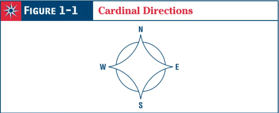
Look at the examples below. Find north, south, east, and west on Figure 1-1. These are the cardinal directions. Turn your book so that north on the compass rose points north (toward the North Pole). Face north yourself. Now east is to your right, west is to your left, and south is behind you.
Direction and
Distance
What You Will Learn
To identify direction and distance information from maps
Reading Strategy
Create a diagram like the one below to list the cardinal and intermediate directions.
Terms to Know
compass rose, cardinal directions, intermediate directions, scale, scale bar
Lesson
1
1
N
S
W E
Figure 1-1
Cardinal Directions
Not all maps are the size of this page, of course. Your classroom may have maps hanging on the wall. These maps are much larger than the ones in your book. But they both show the same earth. Maps have a scale bar to tell you what distance on the earth is represented by a certain distance on the map.
Using Map Scale Bars
Here are some examples of map scale bars. Notice that all lines are the same length, but that each line represents a different distance on the earth. Also notice that the same scale bar can rep-resent distance in miles and kilometers on the map. Look straight north. Hold your right hand
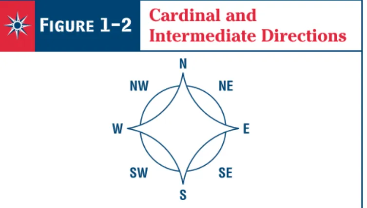
straight out to the side. In what direction are you pointing? You are correct if you said east. Now turn your head just halfway toward your right arm. You are no longer looking north. But you are not looking east, either. You are looking northeast. Look at Figure 1-2. Find northeast, southeast, northwest, and southwest. These are known as intermediate directions.
Figure 1-2
Cardinal and
Intermediate Directions
N NW NE SW SE S W E NFigure 1-3
North Arrow
Using the scale bar to measure distances between places on a map is easy. Use a piece of paper. Put the edge of the paper between the two points you wish to measure. Make a mark on the paper at each point. Then put the piece of paper on the scale bar with one mark at zero. Note where the other point falls on the scale. This gives you the distance.
0 1 mile 0 1 kilometer 0 20 miles 0 30 kilometers 0 200 miles 0 300 kilometers Point A Point B 0 1 2 miles
Notice that Figure 1-3 is just an arrow with its point labeled N. The N stands for north. The arrow points north. When you see a north arrow, remem-ber that east is to the right, west is to the left, and south is in the opposite direction from north.
Distance
If you make a drawing of a person, you will probably not make the picture as large as the per-son. That would take a piece of paper the same size as the person. A map is a drawing of a part of the earth. A map as big as the earth would be too large to put in your pocket and carry with you across Africa! Maps are drawn so that a certain distance on the map represents a much larger dis-tance on the earth. This is called scale. Scale
Reviewing Key Terms
Place each phrase in the box under the correct heading.
Compass Rose Scale
1. 3.
2. 4.
Recalling Facts
Fill in the missing directions on these compass roses. Notice that north is not always in the same place.
1. 2. 3.
4. 5. 6.
helps you find distances on a map may be marked N, S, E, W
can be marked in miles helps you find directions on a map
Using Your Skills
helps you find directions on a map helps you find distances on a map
can be marked in miles may be marked N, S, E, W
N W N N S E N
If the scale bar is not long enough, mark where it ends on the paper. Then slide the paper to the left to line up the new mark with zero. Do this as many times as necessary. Then multiply the num-ber of spaces between marks by the distance each
length of the scale bar represents. For example, if the scale bar represents 100 miles, and you marked off three spaces, then multiply 3 by 100. The distance between the two points on the map is 300 miles.
Practicing Map Skills
Use what you have learned about direction and distance to answer the questions about Map 1-1: The United Stateson page 12.
1. What part of this map shows direction?
2. What part of this map shows distance?
3. If you were in Kansas, in which direction would you have to travel to reach each of the states listed below? Use intermediate directions when necessary. a. South Dakota b. Virginia c. Utah d. Texas e. Washington f. Florida g. New Mexico h. Michigan
4. How many miles does the full length of the scale bar on the map represent?
5. About how many miles is it from east to west across Colorado?
6. About how many miles is it from north to south across Texas at its widest point?
7. How would you measure a distance on the map that is longer than the scale bar?
Place a piece of paper on the map and mark each end point of the distance to be measured.
Place one end point on the scale bar at zero. Put a mark at the end of the scale.
Slide the paper over so the mark lines up with zero. Keep doing this until you reach the end point.
Then multiply the number of spaces by the distance the scale bar represents.
8. About how many miles is it from Ohio to Oklahoma when traveling 800 400 500 northeast southwest southeast northwest south west east north
the scale bar the compass rose
M a p 1 -1
T
h
e
U
n
it
e
d
S
ta
te
s
WASHINGTON OREGON CALIFORNIA ALASKA HAWAII NEVADA IDAHO MONTANA WYOMING UTAH COLORADO ARIZONA NEW MEXICO TEXAS OKLAHOMA KANSAS NEBRASKA SOUTH DAKOTA NORTH DAKOTA MINN. IOWA MISSOURI ARK. LOUISIANA MISS. ALABAMA GEORGIA FLORIDA S.C. N.C. TENNESSEE KENTUCKY ILLINOIS IND. WIS. MICH. OHIO PENN.NEW YORK VIRGINIA
W
.VA.
MD.
MAINE
N.H. VT.
MASS. RHODE ISLAND
CONNECTICUT NEW JERSEY DELAWARE