Disaster Management System Using Google
Map
Jeneetta Silvester1, Jinu George 2,Neeha Ann Jose3, Neha Elsa George 4,Annie Chacko5
B. Tech Student, Department of Computer Science and Engineering, MBCCET, Kuttikanam, Kerala, India1
B. Tech Student, Department of Computer Science and Engineering, MBCCET, Kuttikanam, Kerala, India2
B. Tech Student, Department of Computer Science and Engineering, MBCCET, Kuttikanam, Kerala, India3
B. Tech Student, Department of Computer Science and Engineering, MBCCET, Kuttikanam, Kerala, India4
Head of Department, Computer Science and Engineering, MBCCET, Kuttikanam, Kerala, India5
ABSTRACT: Natural Disasters have undermined human kind since history began. Because of geographic area and environment change, there are numerous powerless nations to regular disasters. The nations additionally needs powerful debacle readiness frame work to face natural disaster. In addition, a tourist may face difficulties in finding safe area or shelter place prior to the occurrence of natural disasters. Therefore, we have proposed a disaster management system and departure framework for individuals utilizing Google Map(GM).The framework is executed on android cell phone in view of the expanding development of cell phones in world. Android gadget with our application introduced on it and user. User can enlist the numerous recipient or relative or companions to send SMS at an opportunity to send notice for offer assistance. By sending the present position acquired by GPS and including most brief way of sanctuary or safe zone on the guide of the application.
KEYWORDS: Natural Disaster, Google Map, Disaster Warning, Safe zone, Android.
I. INTRODUCTION
Natural Disaster is the outcome of regular perils, for example, twister, storm, cyclone, tidal wave, surge and so on. This world has officially watched the awful method of nature which has taken a huge number of lives. The 2011 Japan quake and tidal wave, the 2010 Haiti seismic tremor, the 2008 violent wind Nargis, the 2004 Indian Ocean Tsunami, the 1991 Bangladesh tornado are some ebb and flow cases of deadliest normal calamities. Characteristic risks for the most part wind up with catastrophes where the valuable regions are vulnerable. The report of United Nation's International Strategy for Disaster Reduction (UNISDR) on Mortality Risk Index (MRI) positions the Bangladesh no. 1 among 200 nations most at hazard from tremors, surges, tropical twisters, and avalanches[1].Since in world there are the vast majority of the common catastrophe inclined nation, so avoidance is vital for protecting lives and properties. Here and there individuals might be unconscious about the up and coming normal risks. Absence of familiarity with individuals causes the real harm amid fiasco[4]. Along these lines, adequate earlier catastrophe cautioning and powerful clearing framework can spare significant number of lives in the nation inclined to incessant debacles. Another comer or a guest in a specific zone may confront the issue in discovering safe region from his present remain amid catastrophe. Henceforth, we have anticipated an area construct calamity framework with respect to cell phones utilizing Google Map which is for the most part used to messages on the guide. Google Map(GM) is a quickly developing open source guide of the world as a result of the accessibility of guide data over the world and the approach of ease advantageous GPS gadgets.
and showing closest safe zone or sanctuaries on the guide of the application. Our proposed framework is produced for the typical individuals. The ease of use of Google Map (GM) is guaranteed for all clients as it is free[10]. Clients of our application will send instant message along the bearing on the guide to at least one relative which number client enlist in that application. Whatever is left of the paper is composed as takes after. We talk about some related works and their inadequacies in short. At that point we introduce the portrayal of our proposed area based framework. Framework usage subtle elements are depicted. We have talked about the trial result. At long last, we finish up this paper expressing the future arrangement.
II. RELATEDWORK
Natural Disaster Monitor (Developed by Dominic 925):This Android application gives you ongoing overhauls on any worldwide common catastrophes like earthquake, tsunami, cyclone, floods, and volcano eruptions on the scenery of a Google earth map. The application makes utilization of the alarms distributed by the Global Disaster Alert and Coordination System (GDACS), a joint activity of the United Nations Office for coordination if Humanitarian Affairs (OCHA) and the European Commission[5]. The application demonstrates symbols on the guide with hues green, orange and red, each showing the seriousness of the cataclysm. On tapping the symbols, the drop down list indicates date and time, district, fiasco sort and other related subtle elements. FiascoAlert (Developed by PDC-Pacific Disaster Center):This application brags of 'Dynamic Hazards', an intuitive guide which indicates continuous cautions gathered from definitive sources with points of interest, for example, potential dangers to individuals, property or resources by means of PDC Disaster AWARE application. The application covers worldwide Earthquake, surges, Tsunami, Volcano, Storm, Marine and even synthetic calamities. The organization says the up and coming redesign will incorporate out of control fire cautions too.
Storm Tracker (Developed by WSI-Weather Service Global Corporation):This application makes utilization of the NOWrad (National Operational Weather radar) which gives one of the best determination cloud symbolism with shading codes. It likewise gives 10-day gauges with both day by day and hourly subtle elements. Clients can likewise bolt their favorite areas to monitor the neighborhood. Tidal wave Alert (Developed Palta Software):This application is sure to help individuals living along the beach front lines crosswise over Pacific and Indian Ocean, who saw the substantial scale obliteration by the 2004 Tsunami. The primary highlight of the application is that a client will get continuous overhauls from US government claimed NOAA (National Maritime and Atmospheric Administration) Tsunami cautioning focuses in at regular intervals. It will likewise give insights about the zone influenced, area of earth tremor and additionally give tips on the most proficient method to respond to approaching danger.
In Tsunami Alert application, the client will have the alternative to choose 5 principle locales one US and Canada, Pacific, Hawaii, Indian Ocean and Caribbean Sea[4]. ubAlert-Disaster Alert (Developed by ubAlert):This application is made by interpersonal organization site ubAlert, which accumulates checked records of the general population who were exhibit at ground zero and saw the normal fiasco prior to any media association announced it. Once the individual educates a cataclysm in his/her territory, the system will confirm the news with numerous sources so that there is no degree for false panic. People can transfer pictures and recordings of the occasion from the application to interpersonal organizations like Facebook and Twitter and caution. Worldwide debacle alarm and coordination framework: Fiasco reaction partners GDACS is a collaboration system under the United Nations umbrella. It incorporates fiasco supervisors and debacle data frameworks worldwide and goes for filling the data and coordination crevice in the primary stage after real calamities. Unsurprising data of unsurprising quality at a unsurprising time GDACS is an of existing debacle data administration applications. Early data is anticipated that would be dubious and is refined as better data gets to be distinctly accessible:
• Near constant cautions or early notices about sudden onset debacles, conveyed by email, fax or SMS • Near constant programmed circumstance reports in view of demonstrating and from the earlier data • On-line talk discussion for crisis responders (counting Search and Rescue groups and helpful guide givers) • Rapid circumstance reports in light of field information
GDACS is overseen by a Steering Committee, as of now led by the European Monitoring and Data Center (MIC) in DG ECHO.The Emergency Relief Coordination Center (ERCC) in the Joined Nations Office for Coordination of Helpful Affairs (OCHA) in Geneva goes about as GDACS Secretariat. Annual partners gatherings are gone to by debacle supervisors, researchers, outline, PC researchers and different experts, to characterize gauges for data trade and a technique for facilitate advancement of its apparatuses and administrations.
III.PROPOSEDSYSTEM
The disaster management comprises of four central steps, for example, relief, readiness, reaction, and recuperation. Among these means, the accentuation of our work is the readiness which is the improvement of a framework for the activity plan of fiascos. The ecological area of Bangladesh, a South Asian nation, arranged as it is between the Himalayas and the sea, on the delta of wide waterways, implies that the nation is extremely defenseless against flooding.The general population of beach front territories in Bangladesh need to confront a few tempests every year also, cultivable grounds vanish in waterway because of stream disintegration. Bangladesh is additionally a standout amongst the most defenseless nations to the planet's atmosphere changes. Environmental change is creating a developing number of violent winds, and incomprehensibly, there is a more serious danger of dry spell, too.
The nation is additionally encompassed by the Bay of Bengal which is without a doubt north-eastern part of Indian Ocean and can attack the nation, especially the beach front belt sternly. Thus, there is likewise the danger of Tidal wave in this nation. In any case, our fiasco readiness framework secures the general population of this nation from these calamities and utilizations Google Map (GM) in light of the fact that the advancement of GM is extremely quick. It is committed to empowering the development, improvement and dispersion of free geospatial information and to giving geospatial information to anybody to utilize and share [3]. Google Map is one of the tasks utilizing their created guide of the numerous nations. This proposed work is additionally actualized on android portable telephones.
Android is a working framework for cell phones for example, PDAs and tablet PCs created by Open Handset Alliance drove by Google. Android is more open and exhaustive than other portable working frameworks. Along these lines, it is the smash hit PDA stage around the world. It additionally permits the designers, remote administrators and handset producer to make new applications and items at lower cost. The result is more individual and more intelligent experience to the clients. Along these lines, the android portable stage has been utilized as a part of our proposed calamity readiness framework. Our proposed area based calamity readiness framework comprises of a GPS upheld android cell phones with our proposed application introduced on it and clients having national id. The client of our proposed android application can likewise enlist the quantity of relatives, relative, companions to send message for offer assistance. Through system supplier or GPS supplier, cell phone gets the current area of its client and sends it to enroll part by the client in its application. Utilizing this present position. The client of our proposed application message. Our application gets the present position through GPS or organize supplier from the client cell phone send the latitude and longitude of client's present position. At the point when the client in a calamity zone, it will communicate something specific warning alongside way to the part who can help.in this message client send instant message and way to go after help. The way contain the separation from partner to the client. The separation can be given with the assistance of Google Map to demonstrate the separation by stroll, by railroad or by transport. At the point when the client in a catastrophe zone, it will send a content message.
IV.EXPERIMENTAL RESULTS
User interface design or, user interface engineering is a design of appliances, machines, mobile communication devices, software applications, and websites with the focus on the user's experience and interaction. The goal of user interface design is to make the user's interaction as simple and efficient as possible, in terms of accomplishing user goals—what is often called user-centered design. Good user interface design facilitates finishing the task at hand without drawing unnecessary attention to itself. Graphic design may be utilized to support its usability. The design process must balance technical functionality and visual elements (e.g., mental model) to create a system that is not only operational but also usable and adaptable to changing user needs. Interface design is involved in a wide range of projects from computer systems, to cars, to commercial planes; all of these projects involve much of the same basic human interactions yet also require some unique skills and knowledge. As a result, designers tend to specialize in certain types of projects and have skills centered around their expertise, whether that be software design, user research,web design, or industrial design.
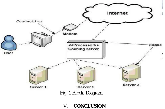
Fig. 1 Block Diagram
V. CONCLUSION
REFERENCES
[1] A. Aloudat, K. Michael and J. Yan, “Location-based services in emergency management- from government to citizens: global case studies,” Recent Advances in Security Technology, P. Mendis, et al., eds., Australian Homeland Security Research Centre, 2007, pp. 190-201.
[2] Android [http://en.wikipedia.org/wiki/Android(operating_system)] .
[3] Dugkeun Park, “One of the Nowcasting Applications: Early Warning Systems for Natural Disasters in Korea,” Oct. 2006. [4] Hidenori Torii, Jun Sawamoto, NorihisaSegawa, EijiSugino, and Yukinori Nomura, “Tsunami Early Alert and Evacuation
Support System for Fishery Workers by Mobile Phones,”24th International Conference on Advanced Informationpp.704-709, Apr.
[5] https://maps.google.co.in .
[6] Jayasinghe,Gamini,Fahmy,Farazy, Gajaweera, Nuwan, and Dias,Dileeka, “A GSM Alarm Device for Disaster Early Warning,”, 1st IEEE international Conference on Industrial and Information Systemspp.383- 387, May 2007.
[7] Marius Cioca,Lucian-Ione Cioca, and Sabin-Corneliu Buraga “SMS Disaster Alert System Programming,”,Second IEE International Conference on Digital Ecosystems and Technologies pp. 260-264, Feb.2008.
[8] R. JebersonRetna Raj1, T. Sasipraba2, “Disaster Management System based on GIS Web Services”, Sathyabama University, Jeppiaar Nagar,Chennai600119,[email protected],[email protected].
[9] Roba Abbas, Katina Michael, M.G. Michael, “The Current State of Commercial Location-based Service”, Offerings in Australia, AnasAloudat School of Information Systems & Technology Australia {ra75, katina, mgm, anas}@uow.edu.au. [10]YasuakiTeshirogi, Jun Sawamoto, NorihishaSegawa, and EijiSugino,“A Proposal of Tsunami Warning System Using Area