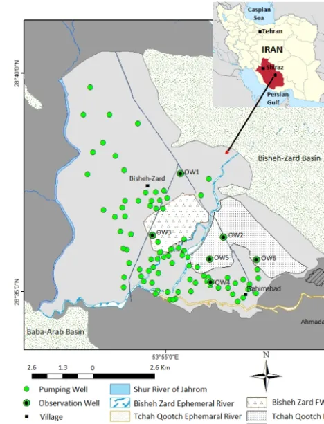
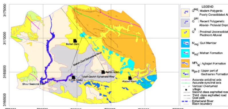
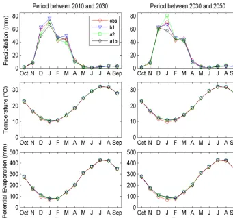
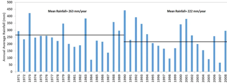
Coupled modeling approach to assess climate change impacts on groundwater recharge and adaptation in arid areas
Full text
Figure


Related documents
a) The surrogate is at minimum of age 18 and must not be menopausal. b) The surrogate must not have pre-existing health conditions that may threaten the chances of a
Figure 4.9 Crystallite size and lattice strain of received material, cold rolled and non pre-heat treated cryorolled Al 1100
Focusing on the data management issue, the scope of this study was on data quality and reliability of RFID readings obtained from passive tags widely used in supply chain management
The multilayer perceptron model constructed for training had an input layer consisting of 7 neurons (injection pressure, mold temperature, injection speed,
Stock Market Predictability in the MENA: Evidence from New Variance Ratio Tests and Technical Trade Analysis Thomas Lagoarde Segot.. Institute for International Integration
Recognizing that there is variability among adjunct faculty members’ ability to use the course management sys- tem and to adapt to one hundred students and an assistant, the college
focus Digitize Customer Journey Pivotal Customer Life Events
DOMINANT FLUID FLOW DIRECTION Example 3 Kirby Creek Waterflood Bubble Map of Water Rates Inj & Prod.. Inj Rate Cal Day
